1
Malkin's Bank Farm
A whitewashed farmhouse to the right, various barns and outbuildings to the left.
Image: © Stephen Craven
Taken: 10 Nov 2019
0.01 miles
2
Horse and pony in a field opposite Malkins Bank Farm
Image: © Stephen Craven
Taken: 10 Nov 2019
0.03 miles
3
View east from Betchton Road
Mow Cop can just be glimpsed on the horizon.
Image: © Stephen Craven
Taken: 10 Nov 2019
0.06 miles
4
Betchton Road, looking north-east
Towards the junction with Stannerhouse Lane.
Image: © Stephen Craven
Taken: 10 Nov 2019
0.06 miles
5
Trent & Mersey canal towards bridge #149
Image: © Ian S
Taken: 28 Jan 2022
0.08 miles
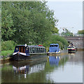
6
Trent and Mersey Canal at Malkin's Bank, Cheshire
This is part of the pound above paired Lock No 61. Ahead is Bridge No 149, formerly a farmer's accommodation bridge, but now just allowing access to the golf course. This is double arched since the 1830s addition of an extra lock was built, but the equipment visible past the bridge shows that the lock is receiving restoration so is not currently in use.
The 93·5 mile canal was opened fully by 1777 having taken eleven years to build.
Image]
Image: © Roger D Kidd
Taken: 31 Aug 2011
0.09 miles
7
Mile Marker 68-24, Bridge 149 Longcroft, T&M Canal
1977 replacement Mile Marker 68-24
Longcroft bridge (no.149)
Image: © Brian Deegan
Taken: 15 Aug 2020
0.10 miles
8
Trent and Mersey Canal at Malkin's Bank, Cheshire
This is the pound between Locks 61 and 60 looking east up the Wheelock flight of eight. The wideness near to the camera shows the presence of a winding hole, where boats up to seventy feet (22 metres) in length can be turned round.
The 93·5 mile canal was opened fully by 1777 having taken eleven years to build.
Image: © Roger D Kidd
Taken: 31 Aug 2011
0.10 miles
9
Replica milemarker by the Trent & Mersey Canal, Malkin's Bank
Replica milemarker by the Trent & Mersey Canal, in parish of Betchton (Congleton District), West of Bridge 149, near Malkins Bank.
Inscription reads:-
: SHARDLOW / 68 / MILES : : PRESTON / BROOK / 24 / MILES :
Maker:-
: 19 / T&MGS / 77 :
Surveyed
Milestone Society National ID: TMC-68
Image: © Milestone Society
Taken: Unknown
0.10 miles
10
Trent & Mersey canal at twin locks #61
Image: © Ian S
Taken: 28 Jan 2022
0.10 miles


