IMAGES TAKEN NEAR TO
Station Road, SANDBACH, CW11 3SU
Introduction
This page details the photographs taken nearby to Station Road, CW11 3SU by members of the Geograph project.
The Geograph project started in 2005 with the aim of publishing, organising and preserving representative images for every square kilometre of Great Britain, Ireland and the Isle of Man.

There are currently over 7.5m images from over14,400 individuals and you can help contribute to the project by visiting https://www.geograph.org.uk
Image Map
Images are licensed for reuse under creativecommons.org/licenses/by-sa/2.0
Notes
- Clicking on the map will re-center to the selected point.
- The higher the marker number, the further away the image location is from the centre of the postcode.
Image Listing (29 Images Found)
Images are licensed for reuse under creativecommons.org/licenses/by-sa/2.0
Image
Details
Distance
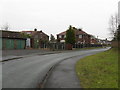
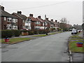
2
Footpath From Gibson Crescent To Ettiley Heath
Image: © Peter Whatley
Taken: 19 Jan 2010
0.11 miles
6
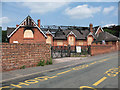
St Peter's church hall, burnt out
The church hall on School Lane is associated with the church on Middlewich Road Image It suffered a major fire in February 2010 and is likely to be demolished once funds can be raised to rebuild it.
Image: © Stephen Craven
Taken: 27 Jun 2010
0.18 miles
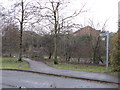
7
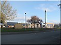
Elworth Church of England Primary School
Associated with St Peter's church nearby Image
Image: © Stephen Craven
Taken: 17 Apr 2016
0.19 miles
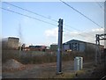
8

XL Engineering, Elworth
According to their website www.xl-eng.co.uk, they specialise in the manufacture of precision sheet metal fabrications. So why is there more timber than metal in their yard? Viewed from the adjacent public footpath.
Image: © Stephen Craven
Taken: 19 Mar 2016
0.19 miles
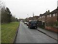
9
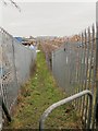
Footpath alongside the railway
Sandbach footpath no 30 runs adjacent to the railway between a pair of security fences. It connects Moss Lane at this end with Millbuck Way.
Image: © Stephen Craven
Taken: 19 Mar 2016
0.20 miles
10
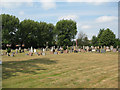
St Peter's churchyard, Elworth
The graveyard behind the Anglican church Image
Image: © Stephen Craven
Taken: 27 Jun 2010
0.20 miles