IMAGES TAKEN NEAR TO
Church Lane, SANDBACH, CW11 2TU

Introduction

This page details the photographs taken nearby to Church Lane, CW11 2TU by members of the Geograph project.

The Geograph project started in 2005 with the aim of publishing, organising and preserving representative images for every square kilometre of Great Britain, Ireland and the Isle of Man.

There are currently over 7.5m images from over14,400 individuals and you can help contribute to the project by visiting https://www.geograph.org.uk

Image Map


Images are licensed for reuse under creativecommons.org/licenses/by-sa/2.0
Notes
  • Clicking on the map will re-center to the selected point.
  • The higher the marker number, the further away the image location is from the centre of the postcode.

Image Listing (20 Images Found)

Images are licensed for reuse under creativecommons.org/licenses/by-sa/2.0
Image
Details
Distance
1
Church Lane, Fourlanes End
Looking east.
Image: © JThomas Taken: 11 Jun 2016
0.06 miles
2
Telephone box, Fourlanes End
Image: © JThomas Taken: 11 Jun 2016
0.09 miles
3
A50, Fourlanes End
Looking south east.
Image: © JThomas Taken: 11 Jun 2016
0.09 miles
4
Houses, Fourlanes End
On the A50.
Image: © JThomas Taken: 11 Jun 2016
0.09 miles
5
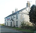
The Salamanca, Fourlanes End
Always a sad sight, a pub that's closed, and especially one with such an unusual name. However, Image is only 200 metres away. Looking along the Newcastle Road towards Rode Heath.
Image: © Derek Harper Taken: 30 Jun 2006
0.10 miles
6
A50 and The Salamanca public house
Now, sadly closed.
Image: © Peter Bond Taken: 17 Jun 2013
0.10 miles
7
The Empty Salamanca Public House
Image: © Anthony Parkes Taken: 11 Apr 2014
0.10 miles
8
Fourlanes End
Houses and barns at Fourlanes End.
Image: © Peter McDermott Taken: 28 Aug 2017
0.11 miles
9
Oakleigh Farm
Pasture near Oakleigh Farm seen from Church Lane.
Image: © Peter McDermott Taken: 28 Aug 2017
0.14 miles
10
The Bull's Head, Fourlanes End
At least Fourlanes End is not dry after the closure of Image This pub is only 200 metres northwest along the Newcastle Road towards Holmes Chapel, and the other side of the crossroads.
Image: © Derek Harper Taken: 30 Jun 2006
0.17 miles