IMAGES TAKEN NEAR TO
Love Lane, SANDBACH, CW11 2TH
Introduction
This page details the photographs taken nearby to Love Lane, CW11 2TH by members of the Geograph project.
The Geograph project started in 2005 with the aim of publishing, organising and preserving representative images for every square kilometre of Great Britain, Ireland and the Isle of Man.

There are currently over 7.5m images from over14,400 individuals and you can help contribute to the project by visiting https://www.geograph.org.uk
Image Map
Images are licensed for reuse under creativecommons.org/licenses/by-sa/2.0
Notes
- Clicking on the map will re-center to the selected point.
- The higher the marker number, the further away the image location is from the centre of the postcode.
Image Listing (10 Images Found)
Images are licensed for reuse under creativecommons.org/licenses/by-sa/2.0
Image
Details
Distance
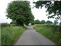
1
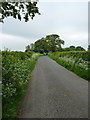
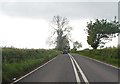
Love Lane - looking north towards Betchton
Image: © Richard Law
Taken: 6 Jun 2013
0.10 miles
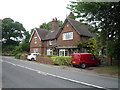
2
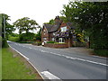
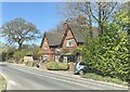
Cottages on Sandbach Road
These are more or less opposite the junction with the B5078 to Lawton Heath End.
Image: © Richard Law
Taken: 6 Jun 2013
0.10 miles
6
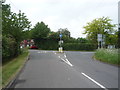
Junction of Chells Hill (B5078) with the A533
Image: © JThomas
Taken: 11 Jun 2016
0.13 miles

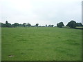
9
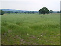
View from Love Lane
A less romantic landscape than one might hope. Beyond the South Cheshire plain rises Mow Cop on the Staffordshire border.
Image: © Derek Harper
Taken: 30 Jun 2006
0.22 miles