IMAGES TAKEN NEAR TO
Moorhead Lane, SANDBACH, CW11 2SS
Introduction
This page details the photographs taken nearby to Moorhead Lane, CW11 2SS by members of the Geograph project.
The Geograph project started in 2005 with the aim of publishing, organising and preserving representative images for every square kilometre of Great Britain, Ireland and the Isle of Man.

There are currently over 7.5m images from over14,400 individuals and you can help contribute to the project by visiting https://www.geograph.org.uk
Image Map
Images are licensed for reuse under creativecommons.org/licenses/by-sa/2.0
Notes
- Clicking on the map will re-center to the selected point.
- The higher the marker number, the further away the image location is from the centre of the postcode.
Image Listing (14 Images Found)
Images are licensed for reuse under creativecommons.org/licenses/by-sa/2.0
Image
Details
Distance
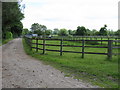
4
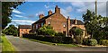
Roadside Farm
Roadside Farm at Illidge Green.
Image: © Peter McDermott
Taken: 28 Aug 2017
0.06 miles
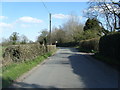
5
![Moorhead Lane [1]](https://s0.geograph.org.uk/geophotos/03/78/27/3782708_c9aeba5a_120x120.jpg)
Moorhead Lane [1]
Looking west towards Illidge Green and a 79 metre spot height.
Image: © Christine Johnstone
Taken: 15 Dec 2013
0.06 miles
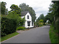
6
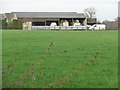
Farm shed, Roadside Farm, Illidge Green
The nearest section appears to be a vehicle store.
Image: © Christine Johnstone
Taken: 15 Dec 2013
0.07 miles
7
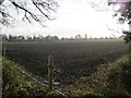
Field with an electric fence, near Illidge Green
The blue pipe must be for extracting water from the tiny River Croco, out of sight immediately to the right [north-west].
Image: © Christine Johnstone
Taken: 15 Dec 2013
0.08 miles
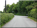
8
![Moorhead Lane [2]](https://s1.geograph.org.uk/geophotos/03/78/27/3782717_ea2bae03_120x120.jpg)
Moorhead Lane [2]
Heading south-east to Moorhead Farm.
Image: © Christine Johnstone
Taken: 15 Dec 2013
0.10 miles
9
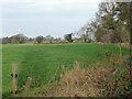
Trees along the River Croco
East of Roadside Farm, Illidge Green.
Image: © Christine Johnstone
Taken: 15 Dec 2013
0.10 miles