1
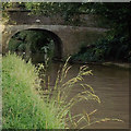
Shropshire Union Canal, Middlewich Branch
The ten mile long Middlewich Branch joins the Shropshire Union Canal to the Trent and Mersey Canal. This view is from the outskirts of Middlewich looking WNW. The next lock from here is Stanthorne.
Image: © David P Howard
Taken: 13 Oct 2010
0.12 miles
2
Shropshire Union Canal, Middlewich Branch
The ten mile long Middlewich Branch joins the Shropshire Union Canal to the Trent and Mersey Canal. This narrowboat is heading away from Middlewich towards Stanthorne Lock.
Image: © David P Howard
Taken: 13 Oct 2010
0.15 miles
3
Middlewich, Flea Lane Bridge - no 28
There is a benchmark cut into the western parapet and into the west face. The cutmark is near the bottom of the steps.
Image: © Mel Towler
Taken: 8 Oct 2022
0.15 miles
4
Bridge no.28, Shropshire Union Canal Middlewich branch
The bridge is Grade II listed, see https://www.historicengland.org.uk/listing/the-list/list-entry/1330026 .
It carries a restricted byway, designated Middlewich RB 7, over the canal.
Image: © Jonathan Hutchins
Taken: 18 Mar 2017
0.15 miles
5
Bridge No 28 in Middlewich, Cheshire
The bridge was probably an accommodation bridge for farmers before housing was built on both sides of the canal. It is now used as a footpath and cycle route (Google maps is numbering it R71, but that confuses me).
The ten mile long Middlewich Branch of the former Chester Canal, with four locks, was opened in 1833, linking the main Chester Canal at Barbridge with the Trent and Mersey about four hundred metres ahead of this image. By 1845 an amalgam of canals and railways resulted in the formation of the Shropshire Union Railways and Canal Company.
Image: © Roger D Kidd
Taken: 27 Aug 2011
0.15 miles
6
Canal bank in Middlewich, Cheshire
Bridge No 28 was probably an accommodation bridge for farmers and a manor before housing was built on both sides of the canal. It is now used as a footpath and cycle route (Google maps is numbering it R71, whatever that means - certainly not the national R71 route further north).
The ten mile long Middlewich Branch of the former Chester Canal, with four locks, was opened in 1833, linking the main Chester Canal at Barbridge with the Trent and Mersey about four hundred metres ahead of this image. By 1845 an amalgam of canals and railways resulted in the formation of the Shropshire Union Railways and Canal Company.
Image: © Roger D Kidd
Taken: 27 Aug 2011
0.15 miles
7
Middlewich, Flea Lane Bridge - no 28
The benchmark is cut into the western parapet and into the west face.
Image: © Mel Towler
Taken: 8 Oct 2022
0.15 miles
8
Signpost beside Shropshire Union Canal Middlewich branch
Image: © Jonathan Hutchins
Taken: 18 Mar 2017
0.15 miles
9
Houses in Manor Park from the canal
Image: © Des Blenkinsopp
Taken: 20 Apr 2015
0.16 miles
10
Hannah's Walk, Middlewich
Hannah's Walk is a public footpath designated Middlewich FP 8 and runs between St Ann's Road and the Shropshire Union Canal.
Image: © Jonathan Hutchins
Taken: 18 Mar 2017
0.18 miles


