Canal bank in Middlewich, Cheshire
Introduction
The photograph on this page of Canal bank in Middlewich, Cheshire by Roger D Kidd as part of the Geograph project.
The Geograph project started in 2005 with the aim of publishing, organising and preserving representative images for every square kilometre of Great Britain, Ireland and the Isle of Man.

There are currently over 7.5m images from over 14,400 individuals and you can help contribute to the project by visiting https://www.geograph.org.uk
Canal bank in Middlewich, Cheshire
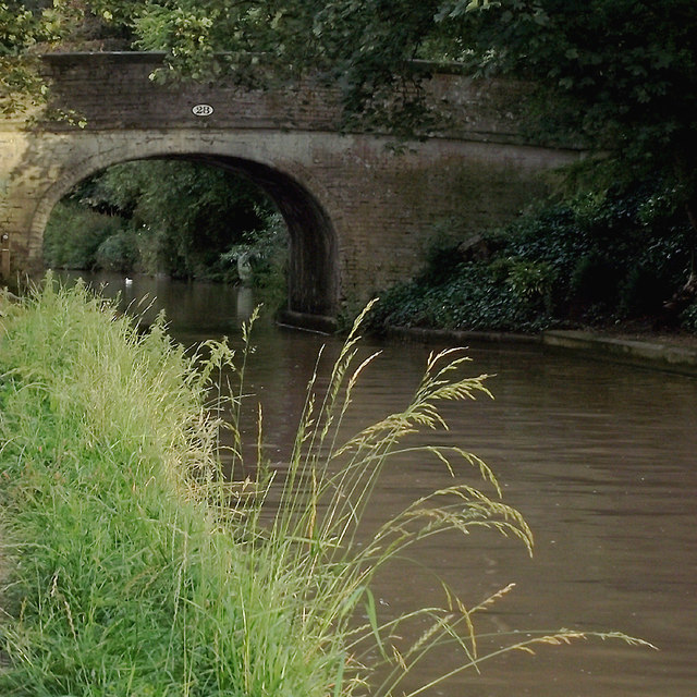
Image: © Roger D Kidd Taken: 27 Aug 2011
Bridge No 28 was probably an accommodation bridge for farmers and a manor before housing was built on both sides of the canal. It is now used as a footpath and cycle route (Google maps is numbering it R71, whatever that means - certainly not the national R71 route further north). The ten mile long Middlewich Branch of the former Chester Canal, with four locks, was opened in 1833, linking the main Chester Canal at Barbridge with the Trent and Mersey about four hundred metres ahead of this image. By 1845 an amalgam of canals and railways resulted in the formation of the Shropshire Union Railways and Canal Company.
Images are licensed for reuse under creativecommons.org/licenses/by-sa/2.0
Image Location
Latitude
53.187701
Longitude
-2.450464