
IMAGES TAKEN NEAR TO
Fennyland Lane, KENILWORTH, CV8 2RS
Introduction
This page details the photographs taken nearby to Fennyland Lane, CV8 2RS by members of the Geograph project.
The Geograph project started in 2005 with the aim of publishing, organising and preserving representative images for every square kilometre of Great Britain, Ireland and the Isle of Man.

There are currently over 7.5m images from over14,400 individuals and you can help contribute to the project by visiting https://www.geograph.org.uk
Image Map
Images are licensed for reuse under creativecommons.org/licenses/by-sa/2.0
Notes
- Clicking on the map will re-center to the selected point.
- The higher the marker number, the further away the image location is from the centre of the postcode.
Image Listing (49 Images Found)
Images are licensed for reuse under creativecommons.org/licenses/by-sa/2.0
Image
Details
Distance
1
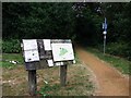
Kenilworth Common nature reserve - northernmost entrance from Common Lane
It is difficult to believe, but this footpath was once the main road from Coventry to Kenilworth before the Coventry Road that we know today was built as a turnpike road in the 1700's.
Image: © John Brightley
Taken: 8 Jul 2010
0.04 miles
2
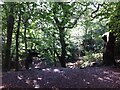
Kenilworth Common
Once a heath used for grazing farm animals, the common was colonised by birch and oak trees once grazing stopped, and is now a wood with a few remnants of heathland. The land slopes down to the Finham Brook and is crossed by the Coventry to Leamington railway. The common is now a local nature reserve: see the website of the Warwickshire Wildlife Trust here https://www.warwickshirewildlifetrust.org.uk/reserves/KenilworthCommon .
Image: © A J Paxton
Taken: 18 Sep 2021
0.07 miles
3
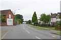
Common Lane Kenilworth
View north west up Common Lane towards its junction with the Coventry rd which can just be seen in the distance
Image: © Nigel Mykura
Taken: 18 Jul 2010
0.09 miles
4

Kenilworth Common during the Cyclocross 2010
A view up the main track from Forge Road to Common Lane.
The cyclocross route comes from the left here (seen in Image]), climbs the hill and turns right up a further rise.
This footpath was once the main road from Coventry to Kenilworth before the Coventry Road that we know today was built as a turnpike road in the 1700's.
Image: © John Brightley
Taken: 26 Dec 2010
0.10 miles
5
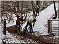
Kenilworth Cyclocross at the Quarry, 2010
The route of the Cyclocross across the Common includes this section in an area known as the Quarry, seen here from the main public footpath across the Common. This is the only time in the year that the gate seen here is ever opened and cyclists are allowed to use this area.
Image: © John Brightley
Taken: 26 Dec 2010
0.11 miles
6
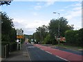
Crackley Hill
Looking down the hill through Crackley towards Coventry, complete with bus!
Image: © David Stowell
Taken: 27 Aug 2005
0.12 miles
7
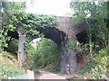
Common Lane bridge
A road overbridge carrying Common Lane over the newly opened section of the Kenilworth Greenway which follows the route of the former Kenilworth-Berkswell railway line.
Image: © E Gammie
Taken: 9 Oct 2011
0.13 miles
9
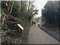
Kenilworth Greenway turns south, Crackley, Kenilworth
The Greenway was created on a former railway line. The information board has accounts of the Kenilworth Sandstone, exposed here, and of the railway.
Image: © Robin Stott
Taken: 22 Jan 2021
0.14 miles
10
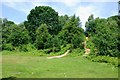
Cleared area inside Kenilworth Common
Image: © Keith Williams
Taken: 8 Jun 2008
0.15 miles