
IMAGES TAKEN NEAR TO
Hodnet Close, KENILWORTH, CV8 2NG
Introduction
This page details the photographs taken nearby to Hodnet Close, CV8 2NG by members of the Geograph project.
The Geograph project started in 2005 with the aim of publishing, organising and preserving representative images for every square kilometre of Great Britain, Ireland and the Isle of Man.

There are currently over 7.5m images from over14,400 individuals and you can help contribute to the project by visiting https://www.geograph.org.uk
Image Map
Images are licensed for reuse under creativecommons.org/licenses/by-sa/2.0
Notes
- Clicking on the map will re-center to the selected point.
- The higher the marker number, the further away the image location is from the centre of the postcode.
Image Listing (28 Images Found)
Images are licensed for reuse under creativecommons.org/licenses/by-sa/2.0
Image
Details
Distance
1
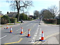
Bollards on Leyes Lane
large parts of the road had been closed to allow resurfacing work to take place. The area here just outside the school gates had been kept clear to allow access through Keeling Rd , the road going off on the left.
Image: © Nigel Mykura
Taken: 25 Mar 2012
0.04 miles
2
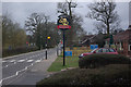
Leyes Lane, Kenilworth
Looking along Leyes Lane from the entrance to the small shopping parade car park. The Banks's sign belongs to the Tiltyard pub.
Image: © Stephen McKay
Taken: 14 Apr 2013
0.07 miles
3
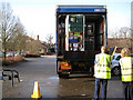
Shoppers' car park, Leyes Lane, Kenilworth
In the foreground, a Sunday morning delivery to the Tesco Express. On the left is the Tiltyard pub - a bungalow seduced by a brewer Image
Image: © Robin Stott
Taken: 17 Jan 2010
0.08 miles
4
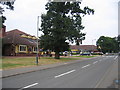
Leyes Lane, Kenilworth
The view shows a small shopping precinct and the Tiltyard pub, built as part of the 1960s and '70s housing development of this area.
Image: © David Stowell
Taken: 23 Jul 2005
0.08 miles
5
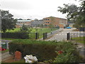
Kenilworth School
The school was originally built in 1963 as Kenilworth Grammar School with a Secondary Modern School Abbey High School next door to it. When all schools were made comprehensive, the two schools were merged. This only shows the part that was the Grammar School.
Image: © Nigel Mykura
Taken: 20 Aug 2012
0.09 miles
6
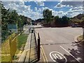
Way in to Kenilworth School, Leyes Lane
As at many secondary school sites, buildings have proliferated. Here there is a sports centre. The school is home to an Air Training Corps and a county music centre.
Photo number 7566679.
Image: © Robin Stott
Taken: 31 Aug 2022
0.10 miles
7
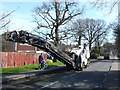
Road Surface Stripper
This machine is parked in Leyes Lane a few metres from its junction with Windy Arbor. Part of the surface had already been removed and more was about to be scraped off.
Image: © Nigel Mykura
Taken: 25 Mar 2012
0.10 miles
8
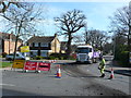
Resurfacing Leyes Lane
Leyes Lane had been closed from the junction with Windy Arbour to the junction with Dencer Drive. The surface was being stripped off in areas where it had deteriorated and new tarmac was then laid. This shows the lorry collecting the old surface material.
Image: © Nigel Mykura
Taken: 25 Mar 2012
0.10 miles
9

Walter Ritchie sculpture 'Growth' at Kenilworth School
For context see Image
'Growth' is made of aluminium and was installed in 1965.
It 'combines simplified figurative elements with semi-abstract biomorphic forms and musical notation against a slate architectural background..The central motif is that of a cell dividing and reproducing itself...The musical notation comes from Beethoven's Missa Solemnis. There is a male figure sitting at the joystick control of an invisible craft. He signifies man's ambitions to explore the limits. The horse symbolises the beneficial power of nature when harnessed to man's endeavour..
(details from 'Public Sculpture of Coventry, Warwickshire and Solihull, by George Noszlopy (Liverpool University Press, 2003))
Image: © John Brightley
Taken: 4 Jul 2010
0.10 miles
10
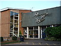
Entrance to Upper School, Kenilworth School, Leyes Lane
The sculpture above the entrance doors was crafted by Walter Ritchie - see Image]
Image: © John Brightley
Taken: 4 Jul 2010
0.10 miles