IMAGES TAKEN NEAR TO
Walnut Tree Close, KENILWORTH, CV8 2NF
Introduction
This page details the photographs taken nearby to Walnut Tree Close, CV8 2NF by members of the Geograph project.
The Geograph project started in 2005 with the aim of publishing, organising and preserving representative images for every square kilometre of Great Britain, Ireland and the Isle of Man.

There are currently over 7.5m images from over14,400 individuals and you can help contribute to the project by visiting https://www.geograph.org.uk
Image Map
Images are licensed for reuse under creativecommons.org/licenses/by-sa/2.0
Notes
- Clicking on the map will re-center to the selected point.
- The higher the marker number, the further away the image location is from the centre of the postcode.
Image Listing (60 Images Found)
Images are licensed for reuse under creativecommons.org/licenses/by-sa/2.0
Image
Details
Distance
1
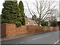
The wall remains
Behind this wall used to lie a Victorian mansion and mini-estate called The Hermitage. The main house is long-demolished and the land built over. This wall and what appears to be a blocked up entrance are all that remain.
Image: © Colin Craig
Taken: 1 Feb 2009
0.02 miles
2
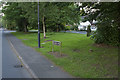
Birches Lane Kenilworth
Taken to show the street sign rather than anything else. This is another very leafy suburb of Kenilworth.
Image: © Malcolm Neal
Taken: 26 May 2017
0.03 miles
3
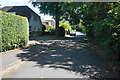
Ferndale Drive
A quiet residential cul-de-sac. The foliage on the right provides a screen against the busy A452 which is just the other side.
Image: © Bill Boaden
Taken: 16 Jul 2022
0.07 miles
4
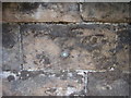
Nineteenth-century benchmark on railway bridge
This bench mark was established between 1850 and 1856 during the First primary levelling of England & Wales, and was levelled with a height of 281.2250 feet [85.7174 metres] above mean sea level (Liverpool datum). It was included on the Basingstoke to Coventry levelling line. The surveyor's description was "No. 229. Bolt in West battlement of bridge over Leamington and Coventry railway ; 2.37 ft. below top of battlement" (Public Abstract p.241). Not found on the 1888 map, perhaps because the arrow mark had already worn away by then. Only the bolt remains. It can be found on the north face of the parapet, west of the railway, beneath the overhanging branches of a sycamore tree.
Image: © Shantavira
Taken: 16 Jun 2015
0.08 miles
5
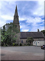
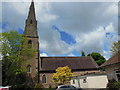
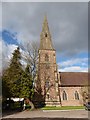
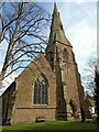
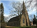
St John's Parish Church, Kenilworth
The Church of St John the Evangelist , on Warwick Road in Kenilworth, is an Anglican Parish Church dating from 1851-2. It is a Grade II* listed building (http://www.britishlistedbuildings.co.uk/en-307853-church-of-st-john-evangelist-kenilworth - British Listed Buildings).
The church has its own web site http://www.kenjohn.plus.com/
Image: © David Dixon
Taken: 7 Aug 2011
0.10 miles