
IMAGES TAKEN NEAR TO
Manor Road, KENILWORTH, CV8 2GG
Introduction
This page details the photographs taken nearby to Manor Road, CV8 2GG by members of the Geograph project.
The Geograph project started in 2005 with the aim of publishing, organising and preserving representative images for every square kilometre of Great Britain, Ireland and the Isle of Man.

There are currently over 7.5m images from over14,400 individuals and you can help contribute to the project by visiting https://www.geograph.org.uk
Image Map
Images are licensed for reuse under creativecommons.org/licenses/by-sa/2.0
Notes
- Clicking on the map will re-center to the selected point.
- The higher the marker number, the further away the image location is from the centre of the postcode.
Image Listing (97 Images Found)
Images are licensed for reuse under creativecommons.org/licenses/by-sa/2.0
Image
Details
Distance
1
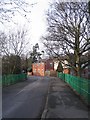
Manor Road
At Washbrook Bridge over the Finham Brook. Tainters Hill Mill (otherwise known as the Water Tower) behind the building in the centre.
Image: © E Gammie
Taken: 30 Jan 2008
0.02 miles
2
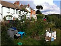
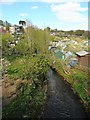
Lower Ladyes Hills, Kenilworth, seen from the entrance to the Odibourne Allotments
The allotments, which were established in the valley of the Finham Brook in 1919, were open to the public as part of the Heritage Open Days.
Image: © A J Paxton
Taken: 18 Sep 2021
0.03 miles
3
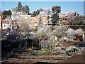
Frost at Odibourne allotments
The flat roofed buildings in the background are the flats at Alpine Court.
Image: © John Brightley
Taken: 7 Dec 2010
0.03 miles
4
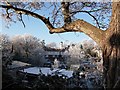
Frost at Odibourne allotments
A view towards Tainters Hill converted water tower from the car parking area at The Close.
Image: © John Brightley
Taken: 7 Dec 2010
0.03 miles
6
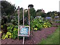
Plot 58a, Odibourne Allotments, Kenilworth
These allotments, which to this city dweller appear impossibly idyllic, were open to the public for the Heritage Open Days 2021. Behind the idyll, of course, lies hard work and long term commitment, the challenge of group politics, the uncertainty of the weather and the threat, even here, of theft and vandalism. The Odibourne allotments were established in 1919.
Image: © A J Paxton
Taken: 18 Sep 2021
0.03 miles
7
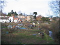
Lower Ladyes Hills
A happy mix of housing styles fronted by long-established allotments alongside Finham Brook.
Image: © E Gammie
Taken: 30 Jan 2008
0.04 miles
8
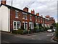
Lower Ladyes Hills, Kenilworth
This row of houses at the Tainters Hill end of Lower Ladyes Hills was the setting for one of the locations of filming for the feature film 'Nativity' during September 2008. The terrace was fitted with Christmas lights and artificial snow was used to make a winter scene.
'Nativity' (released in November 2009) stars Martin Freeman, Ashley Jensen, Jason Watkins and Marc Wootton. It was written and directed by Coventry resident Debbie Isitt, a number of other locations in Coventry and Warwickshire were used and the film also premiered in Coventry. http://en.wikipedia.org/wiki/Nativity!_(film)
https://web.archive.org/web/20091120063321/http://www.coventrytelegraph.net/news/coventry-news/2008/09/17/alan-carr-and-martin-freeman-put-coventry-on-movie-map-92746-21837930/
Image: © John Brightley
Taken: 17 Jul 2010
0.04 miles
9
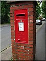
Post box, Manor Road, Kenilworth
Box no. CV8 394 at the corner of Tainters Hill, a G VI R box made by W.T. Allen & Co., London.
Image: © John Brightley
Taken: 26 May 2010
0.05 miles
10
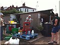
Apple Pressing at Odibourne Allotments, Kenilworth
The allotment site was open to the public as part of the Heritage Open Days 2021 and Edible England events.
Image: © A J Paxton
Taken: 18 Sep 2021
0.05 miles