
IMAGES TAKEN NEAR TO
Leagh Close, KENILWORTH, CV8 2FN
Introduction
This page details the photographs taken nearby to Leagh Close, CV8 2FN by members of the Geograph project.
The Geograph project started in 2005 with the aim of publishing, organising and preserving representative images for every square kilometre of Great Britain, Ireland and the Isle of Man.

There are currently over 7.5m images from over14,400 individuals and you can help contribute to the project by visiting https://www.geograph.org.uk
Image Map
Images are licensed for reuse under creativecommons.org/licenses/by-sa/2.0
Notes
- Clicking on the map will re-center to the selected point.
- The higher the marker number, the further away the image location is from the centre of the postcode.
Image Listing (53 Images Found)
Images are licensed for reuse under creativecommons.org/licenses/by-sa/2.0
Image
Details
Distance
2
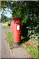
George VI Postbox on Coventry Road, Kenilworth
Image: © Ian S
Taken: 29 Aug 2019
0.07 miles

4
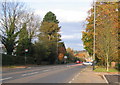
Crackley Hill, autumn
Looking towards Coventry down the main road between Kenilworth and Coventry (A429).
Image: © E Gammie
Taken: 2 Nov 2007
0.08 miles
5
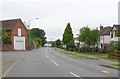
Common Lane Kenilworth
View north west up Common Lane towards its junction with the Coventry rd which can just be seen in the distance
Image: © Nigel Mykura
Taken: 18 Jul 2010
0.08 miles
6

New Footbridge on Crackley Hill
The new footbridge is at the bottom of the hill where the far more substantial railway bridge used to be. The footbridge carries the Coventry Way footpath over the Kenilworth to Coventry main road the A429. The road used to be the A46 trunk road when the railway bridge was there.
Image: © Nigel Mykura
Taken: 4 Mar 2012
0.09 miles
7

The Kenilworth Greenway crossing Coventry Road
Image: © Mat Fascione
Taken: 18 Apr 2015
0.09 miles
8
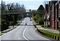
Footbridge across Coventry Road in Crackley
The bridge carries the Kenilworth Greenway across the road.
Image: © Mat Fascione
Taken: 18 Apr 2015
0.09 miles
9
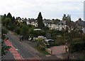
Crackley Hill
The semi-detached houses on Coventry Road (A429) date from about the 1930s and are typical of the linear development that took place along main roads at the outskirts of towns at that time.
Image: © E Gammie
Taken: 9 Oct 2011
0.09 miles
10
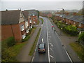
Crackley, A429
This section of the road from Kenilworth to Coventry; seen from Image
Image: © Mike Faherty
Taken: 17 Nov 2019
0.10 miles