IMAGES TAKEN NEAR TO
Meer End Road, KENILWORTH, CV8 1PW
Introduction
This page details the photographs taken nearby to Meer End Road, CV8 1PW by members of the Geograph project.
The Geograph project started in 2005 with the aim of publishing, organising and preserving representative images for every square kilometre of Great Britain, Ireland and the Isle of Man.

There are currently over 7.5m images from over14,400 individuals and you can help contribute to the project by visiting https://www.geograph.org.uk
Image Map
Images are licensed for reuse under creativecommons.org/licenses/by-sa/2.0
Notes
- Clicking on the map will re-center to the selected point.
- The higher the marker number, the further away the image location is from the centre of the postcode.
Image Listing (22 Images Found)
Images are licensed for reuse under creativecommons.org/licenses/by-sa/2.0
Image
Details
Distance
1
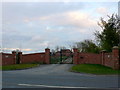
Malthouse Farm
One of the many large expensive residences in this area that is a non-farm farm. There is a row of about half a dozen similar large houses along this bit of the road, some with outdoor equestrian schools, tennis courts, and of course swimming pools.
Image: © Nigel Mykura
Taken: 14 Apr 2012
0.08 miles
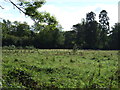
2
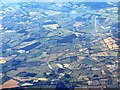
Meer End and the former RAF Honiley
The RAF station closed in 1958 https://en.wikipedia.org/wiki/RAF_Honiley and has been since been used as a vehicle testing facility. Looking southwest from above Coventry.
Image: © M J Richardson
Taken: 5 Jul 2018
0.12 miles
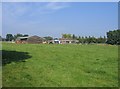
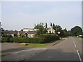
3
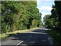
Meer End Road (A4177)
Towards Balsall Common.
Image: © JThomas
Taken: 6 Oct 2012
0.14 miles
4
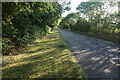
The A4177 south of Meer End
There is a nicely mowed verge to walk on.
Image: © Bill Boaden
Taken: 15 Jul 2022
0.15 miles
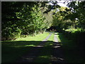
7
Stables at Meer End
Seen from the footpath from Kenilworth.
Image: © David Stowell
Taken: 4 Sep 2005
0.17 miles
8
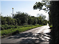
Table Oak Lane
Looking west from near the Tipperary public house
Image: © Robin Stott
Taken: 22 May 2010
0.17 miles
9
Meer End
Looking NNE along the main road to Balsall Common. The pub on the left is The Famous Tipperary Arms shown on the OS Map.
Image: © David Stowell
Taken: 3 Sep 2005
0.17 miles
10
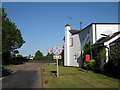
The north side of The Tipperary
Where the west end of Table Oak Lane joins Meer End Road A4177. Postbox number is CV8 387.
Image: © Robin Stott
Taken: 22 May 2010
0.17 miles