
IMAGES TAKEN NEAR TO
Red Lane, KENILWORTH, CV8 1PE
Introduction
This page details the photographs taken nearby to Red Lane, CV8 1PE by members of the Geograph project.
The Geograph project started in 2005 with the aim of publishing, organising and preserving representative images for every square kilometre of Great Britain, Ireland and the Isle of Man.

There are currently over 7.5m images from over14,400 individuals and you can help contribute to the project by visiting https://www.geograph.org.uk
Image Map
Images are licensed for reuse under creativecommons.org/licenses/by-sa/2.0
Notes
- Clicking on the map will re-center to the selected point.
- The higher the marker number, the further away the image location is from the centre of the postcode.
Image Listing (29 Images Found)
Images are licensed for reuse under creativecommons.org/licenses/by-sa/2.0
Image
Details
Distance
1
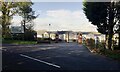
Entrance to Broadwell Woods, Red Lane, Burton Green
Broadwell Woods is described as a luxury park homes site https://avon-estates.co.uk/broadwell-woods/ Photographed in 2017. The site will be close to the HS2 high speed rail line Image
Image: © Robin Stott
Taken: 25 Oct 2017
0.05 miles
2
Green belt
Between Coventry and Kenilworth.
Image: © E Gammie
Taken: 16 Apr 2012
0.07 miles
3
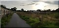
Shared Use Path, Burton Green
This shared use path is quite newly constructed and forms part of the Kenilworth Greenway HS2 diversion which is in place for the duration of the works. The new Burton Green village hall is in the background.
Image: © Paul Collins
Taken: 10 Sep 2023
0.09 miles
5
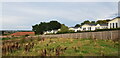
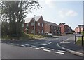
Broadwell Woods, Burton Green
The homes of Broadwell Woods can be seen behind the fence. The construction of HS2 can just be seen in the left distance - there is a large mound of soil.
Image: © Paul Collins
Taken: 10 Sep 2023
0.10 miles
6
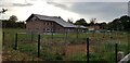
Burton Green Village Hall
This impressive village hall is newly built, I imagine as compensation for the disruption caused by HS2 which is being built right through the village.
Image: © Paul Collins
Taken: 10 Sep 2023
0.10 miles
7
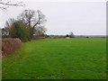
Countryside near Burton Green
View north towards the old disused railway track from close to the southern edge of Burton Green on Red Lane.
Image: © Nigel Mykura
Taken: 6 Mar 2011
0.11 miles
8
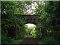
Bridge over the Greenway
A bridge that formerly carried a farm track - it seems to have been unused for some years and has trees growing on top of it. It is, however, in very good condition.
Image: © John Brightley
Taken: 17 Jul 2010
0.11 miles
9
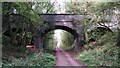
Bridge over the Kenilworth Greenway
Presumably when this railway loop was built in the 1880s, there was a farm track on the Stoneleigh estate which crossed it here and was duly provided with a fine bridge. There is no sign of a track on the OS map now. We are looking northwest towards Burton Green and approaching the end of the walkable section of former railway; a little beyond here it is eaten up by HS2 high speed rail workings and walkers are diverted. On the Greenway, see Image
Image: © A J Paxton
Taken: 10 Oct 2023
0.11 miles
10
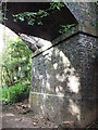
Detail of bridge over Greenway
Detail of bridge shown in Image]
Image: © John Brightley
Taken: 17 Jul 2010
0.11 miles