
IMAGES TAKEN NEAR TO
Oldwich Lane East, KENILWORTH, CV8 1NR
Introduction
This page details the photographs taken nearby to Oldwich Lane East, CV8 1NR by members of the Geograph project.
The Geograph project started in 2005 with the aim of publishing, organising and preserving representative images for every square kilometre of Great Britain, Ireland and the Isle of Man.

There are currently over 7.5m images from over14,400 individuals and you can help contribute to the project by visiting https://www.geograph.org.uk
Image Map
Images are licensed for reuse under creativecommons.org/licenses/by-sa/2.0
Notes
- Clicking on the map will re-center to the selected point.
- The higher the marker number, the further away the image location is from the centre of the postcode.
Image Listing (15 Images Found)
Images are licensed for reuse under creativecommons.org/licenses/by-sa/2.0
Image
Details
Distance
1
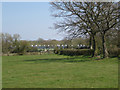
Battery houses near Fen End Farm
Seen from the Heart of England Way, which winds through the Midlands between Milford near Stafford and Bourton on the Water in the Cotswolds.
Image: © Robin Stott
Taken: 17 Apr 2010
0.07 miles
2
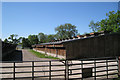
Intensive production of something
Another row of houses lies beyond this on the map. One house can be glimpsed, left. Their roofs are seen in Image
Image: © Robin Stott
Taken: 22 May 2010
0.08 miles
3
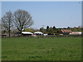
Farm buildings north of Oldwich Lane West
Image: © Robin Stott
Taken: 17 Apr 2010
0.08 miles
4
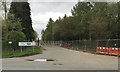
Entrance remodelling, Jaguar Land Rover, Oldwich Lane East, Fen End
An update to Nigel Mykura's Image from 2011. The proving ground has become another of the JLR sites through Warwickshire, Coventry and Birmingham.
Image: © Robin Stott
Taken: 17 Apr 2017
0.14 miles
5
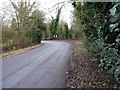
Tight left on Oldwich Lane East
Or a tight right, coming from the other direction.
Image: © Richard Law
Taken: 7 Jan 2019
0.15 miles
6

Entrance to Prodrive.
This is the closely guarded entrance to the Prodrive proving ground which occupies the old Fen End airfield.
Image: © Nigel Mykura
Taken: 24 Apr 2011
0.16 miles
7
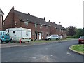
Fen End
The small cluster of houses at Fen End were originally associated with the RAF station connected to the nearby airfield. There is now no military involvement and the airfield is an automotive proving ground belonging to Prodrive.
Image: © Nigel Mykura
Taken: 28 Apr 2011
0.17 miles
8
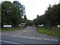
Vehicle Proving ground entrance
Much of this square and the adjacent one to the east is taken up with a vehicle proving ground built on an old airfield. This is the entrance to the site from Oldwich Lane East near the northern edge of the square.
Image: © David Stowell
Taken: 25 Aug 2005
0.18 miles
9
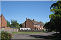
Houses, Oakley
Oakley is the road name of a small isolated housing estate off Oldwich Lane East – perhaps former County Council rural housing or built for the servicemen based at the adjacent Honiley airfield.
Image: © Robin Stott
Taken: 22 May 2010
0.18 miles
10
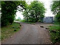
Communications Mast
This mast is just off Oldfield Lane close to the entrance to the old Fen End airfield which is now the Prodrive automotive proving ground.
Image: © Nigel Mykura
Taken: 24 Apr 2011
0.19 miles