
IMAGES TAKEN NEAR TO
Mortimer Road, KENILWORTH, CV8 1FR
Introduction
This page details the photographs taken nearby to Mortimer Road, CV8 1FR by members of the Geograph project.
The Geograph project started in 2005 with the aim of publishing, organising and preserving representative images for every square kilometre of Great Britain, Ireland and the Isle of Man.

There are currently over 7.5m images from over14,400 individuals and you can help contribute to the project by visiting https://www.geograph.org.uk
Image Map
Images are licensed for reuse under creativecommons.org/licenses/by-sa/2.0
Notes
- Clicking on the map will re-center to the selected point.
- The higher the marker number, the further away the image location is from the centre of the postcode.
Image Listing (37 Images Found)
Images are licensed for reuse under creativecommons.org/licenses/by-sa/2.0
Image
Details
Distance
1
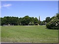
St John's Playing Fields, Kenilworth
Looking NE from Guy Road. The spire of St. John's Church in Image after which the fields are named, can be seen right of centre.
Image: © David P Howard
Taken: 22 Jun 2010
0.02 miles
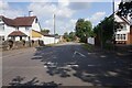
3
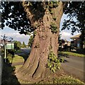
Trunk of a veteran oak, Rouncil Lane, Kenilworth
This is the trunk of the pedunculate oak at the corner of Rouncil Lane and Mortimer Road; see Image
Image: © A J Paxton
Taken: 24 Aug 2023
0.07 miles
4
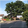
Veteran oak, Rouncil Lane, Kenilworth
This fine pedunculate oak, Quercus robur, stands at the corner of Rouncil Lane and Mortimer Road in the suburbs of Kenilworth. The Woodland Trust classify it as a veteran tree, with a girth of 5.06m at the conventional measuring height of 1.5m https://ati.woodlandtrust.org.uk/tree-search/tree?treeid=80463&from=3523&v=2358934&ml=map&z=18&nwLat=52.33412818038196&nwLng=-1.5781692122101498&seLat=52.332403940921914&seLng=-1.5759590719818783#/ .
Image: © A J Paxton
Taken: 24 Aug 2023
0.08 miles
5
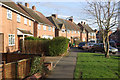
Guy Road, Kenilworth
Local authority built housing in the St Johns area of Kenilworth.
Image: © Stephen McKay
Taken: 27 Jan 2008
0.09 miles
6
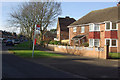
Dudley Road, Kenilworth
Part of an extensive estate of post-war local authority built housing.
Image: © Stephen McKay
Taken: 27 Jan 2008
0.09 miles
7
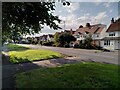
Rouncil Lane, Kenilworth
This suburban stretch of lane with its wide verge on one side is of a type quite common in this area; Broad Lane and Green Lane in Coventry are other examples.
Image: © A J Paxton
Taken: 24 Aug 2023
0.12 miles
8
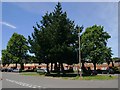
Roseland Road, Kenilworth
Junction of Roseland Road, Guy Road and St. John's Street.
Image: © David P Howard
Taken: 22 Jun 2010
0.12 miles
9
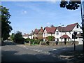
Rouncil Lane, Kenilworth
Looking west along Rouncil Lane at the junction with Mortimer Road.
Image: © David Stowell
Taken: 30 Aug 2005
0.13 miles
10
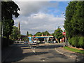
Kenilworth
The one way system at the junction of the old Leek Wootton/Warwick Road and the Leamington Road.
Image: © David Stowell
Taken: 27 Aug 2005
0.14 miles