
IMAGES TAKEN NEAR TO
Fernhill Close, KENILWORTH, CV8 1AN
Introduction
This page details the photographs taken nearby to Fernhill Close, CV8 1AN by members of the Geograph project.
The Geograph project started in 2005 with the aim of publishing, organising and preserving representative images for every square kilometre of Great Britain, Ireland and the Isle of Man.

There are currently over 7.5m images from over14,400 individuals and you can help contribute to the project by visiting https://www.geograph.org.uk
Image Map
Images are licensed for reuse under creativecommons.org/licenses/by-sa/2.0
Notes
- Clicking on the map will re-center to the selected point.
- The higher the marker number, the further away the image location is from the centre of the postcode.
Image Listing (107 Images Found)
Images are licensed for reuse under creativecommons.org/licenses/by-sa/2.0
Image
Details
Distance
1
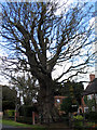
Veteran tree in Fieldgate Lane
According to the Woodland Trust ancient tree site, this tree has been recorded by the Warwickshire Biological Records Centre as a veteran pedunculate oak with a trunk girth of 6.40m (tree no. 80214).
Image: © E Gammie
Taken: 16 Apr 2012
0.07 miles
2
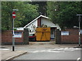
Bungalow being refurbished, Fieldgate Lane
Image: © John Brightley
Taken: 17 Jul 2010
0.08 miles
3
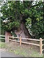
Bole of a pedunculate oak, Fieldgate Lane, Kenilworth
For more information and a full view of this impressive veteran tree, see Image
Image: © A J Paxton
Taken: 10 Oct 2023
0.08 miles
4
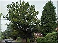
Veteran oak tree, Fieldgate Lane, Kenilworth
This massive tree stands in a front garden in Fieldgate Lane, but can be seen from the road. It appears to be the veteran tree recorded in this vicinity in the ancient tree inventory of the Woodland Trust, as a pedunculate oak, Quercus robur, with a girth of 6.4m at a height of 1.5m https://ati.woodlandtrust.org.uk/tree-search/tree?treeid=80214&from=3523&v=2422369&ml=map&z=17&nwLat=52.35465710336496&nwLng=-1.584782015103099&seLat=52.35117739113758&seLng=-1.5803402769744368#/ . For a close up of the bole or trunk, see Image For a photo of this tree leafless from 2012 see Image
Image: © A J Paxton
Taken: 10 Oct 2023
0.08 miles
5
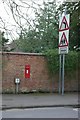
Victorian postbox, Fieldgate Lane, Kenilworth
Image: © Keith Williams
Taken: 2 May 2008
0.09 miles
6
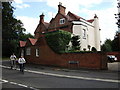
Fieldgate House, Fieldgate Lane
A large house converted in to flats. Seen from the end of Hollis Lane.
Image: © John Brightley
Taken: 17 Jul 2010
0.12 miles
7
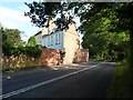
Fieldgate House and Thirlwall
Two houses, at least in part late 17th century albeit with alterations through the 18th & 19th centuries as well. They were collectively Grade II listed https://britishlistedbuildings.co.uk/101300479-fieldgate-housethirlwall-kenilworth#.XUvHGOhKhPY & https://historicengland.org.uk/listing/the-list/list-entry/1300479 in 1971.
Image: © Richard Law
Taken: 27 Jun 2019
0.12 miles
8
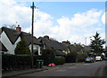
Fieldgate Lane
Thatched houses of indeterminate age in Fieldgate Lane.
Image: © E Gammie
Taken: 16 Apr 2012
0.13 miles
9
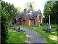
The Roman Catholic church of St Augustine
Hidden away behind hedges and gates on the north side of Kenilworth, this small RC church dates from around 1840 and was Grade II listed https://britishlistedbuildings.co.uk/101035333-roman-catholic-church-of-st-augustine-kenilworth#.XUvIaehKhPY & https://historicengland.org.uk/listing/the-list/list-entry/1035333 in 1949. The architect was Augustus Welby Northmore Pugin.
Image: © Richard Law
Taken: 27 Jun 2019
0.15 miles
10
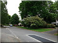
Berkeley Road, Kenilworth
The large trees between the houses on the right mark the site of one of two former stone quarries along this road (the second is by the bend in the distance),from which reputedly stone was obtained to build the Castle and the Abbey. They are overgrown, but still clearly visible holes in the ground. Forty years after the housing estate was built, these two pieces of land are still owned by the estate's developers', Bryant Homes.
Image: © John Brightley
Taken: 26 May 2010
0.15 miles