
IMAGES TAKEN NEAR TO
Bayton Road Industrial Estate, Bayton Road, COVENTRY, CV7 9EL
Introduction
This page details the photographs taken nearby to Bayton Road Industrial Estate, Bayton Road, CV7 9EL by members of the Geograph project.
The Geograph project started in 2005 with the aim of publishing, organising and preserving representative images for every square kilometre of Great Britain, Ireland and the Isle of Man.

There are currently over 7.5m images from over14,400 individuals and you can help contribute to the project by visiting https://www.geograph.org.uk
Image Map
Images are licensed for reuse under creativecommons.org/licenses/by-sa/2.0
Notes
- Clicking on the map will re-center to the selected point.
- The higher the marker number, the further away the image location is from the centre of the postcode.
Image Listing (14 Images Found)
Images are licensed for reuse under creativecommons.org/licenses/by-sa/2.0
Image
Details
Distance
2
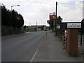
Bayton Road Industry
Bayton Road Industrial Estate is laid out in zones which are indicated by these very visible signs.
Image: © Michael Patterson
Taken: 3 Jul 2006
0.08 miles
4
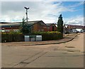
Industrial Estate, Brindley Road, Bedworth
Image: © Alex McGregor
Taken: 7 Jun 2011
0.14 miles
5

Exhall: Hanson Premix ready mixed concrete plant
The ready mixed concrete plant is on Bryant Road in the Bayton Road industrial estate.
Image: © Nigel Cox
Taken: 31 Dec 2011
0.14 miles

7

Gurdwara (Sikh temple), Bayton Road, Bedworth
Gurdwara on the Bayton Road industrial estate, in among the sheet metal and plastics factories. There is another gurdwara almost opposite, a modest single-storey building unadorned by a dome. The one photographed is called Gurdwara Baba Vadbhag Singh Ji.
Image: © A J Paxton
Taken: 30 May 2021
0.17 miles
8
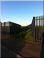
Footpath from Bayton Road industrial estate to pedestrian tunnel under the railway
The path is bounded by metal fencing on both sides. It seems an odd place to put a path, were it not for the tunnel at the end. The OS Six Inch Map, 1888-1913 Series, shows a settlement here, Little Bayton, off Sydnall Lane (the modern Bayton Road), large enough to support a chapel, the houses along a street where this path now runs. There is no sign of Little Bayton today. https://maps.nls.uk/geo/explore/side-by-side/#zoom=16&lat=52.46645&lon=-1.47469&layers=6&right=OSAPI
Image: © A J Paxton
Taken: 30 May 2021
0.17 miles
9
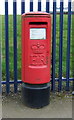
Elizabeth II postbox on Bayton Road, Exhall
Image: © JThomas
Taken: 11 Mar 2017
0.20 miles
10

Elizabeth II postbox (business box) on Bayton Road, Exhall
Image: © JThomas
Taken: 11 Mar 2017
0.20 miles