Footpath from Bayton Road industrial estate to pedestrian tunnel under the railway
Introduction
The photograph on this page of Footpath from Bayton Road industrial estate to pedestrian tunnel under the railway by A J Paxton as part of the Geograph project.
The Geograph project started in 2005 with the aim of publishing, organising and preserving representative images for every square kilometre of Great Britain, Ireland and the Isle of Man.

There are currently over 7.5m images from over 14,400 individuals and you can help contribute to the project by visiting https://www.geograph.org.uk
Footpath from Bayton Road industrial estate to pedestrian tunnel under the railway
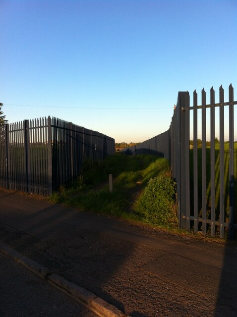
Image: © A J Paxton Taken: 30 May 2021
The path is bounded by metal fencing on both sides. It seems an odd place to put a path, were it not for the tunnel at the end. The OS Six Inch Map, 1888-1913 Series, shows a settlement here, Little Bayton, off Sydnall Lane (the modern Bayton Road), large enough to support a chapel, the houses along a street where this path now runs. There is no sign of Little Bayton today. https://maps.nls.uk/geo/explore/side-by-side/#zoom=16&lat=52.46645&lon=-1.47469&layers=6&right=OSAPI
Images are licensed for reuse under creativecommons.org/licenses/by-sa/2.0
Image Location
Latitude
52.464739
Longitude
-1.473161