IMAGES TAKEN NEAR TO
Breach Oak Lane, COVENTRY, CV7 8AU
Introduction
This page details the photographs taken nearby to Breach Oak Lane, CV7 8AU by members of the Geograph project.
The Geograph project started in 2005 with the aim of publishing, organising and preserving representative images for every square kilometre of Great Britain, Ireland and the Isle of Man.

There are currently over 7.5m images from over14,400 individuals and you can help contribute to the project by visiting https://www.geograph.org.uk
Image Map
Images are licensed for reuse under creativecommons.org/licenses/by-sa/2.0
Notes
- Clicking on the map will re-center to the selected point.
- The higher the marker number, the further away the image location is from the centre of the postcode.
Image Listing (7 Images Found)
Images are licensed for reuse under creativecommons.org/licenses/by-sa/2.0
Image
Details
Distance
1
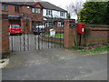
Elizabeth II postbox on Breach Oak Lane
Postbox No. CV7 104.
See Image] for postbox.
Image: © JThomas
Taken: 11 Mar 2017
0.02 miles
2
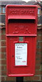
Close up, Elizabeth II postbox on Breach Oak Lane
Postbox No. CV7 104.
See Image] for wider view.
Image: © JThomas
Taken: 11 Mar 2017
0.02 miles
3
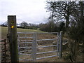
Footpath to Taffs Farm
This footpath passes through a less than romantic galvanised steel kissing gate.
Image: © Michael Patterson
Taken: 21 Mar 2006
0.15 miles
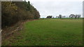
4
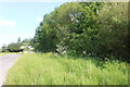
Grazing beside Smorrall Lane
Looking west from Breach Oak Lane.
Image: © JThomas
Taken: 11 Mar 2017
0.22 miles
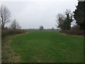
5
Farmland east of Corley
Open fields between Corley and Bedworth.
Image: © Peter Mackenzie
Taken: 20 Feb 2017
0.22 miles
6
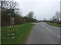
Smorrall Lane
Looking north east at the junction with Breach Oak Lane.
Image: © JThomas
Taken: 11 Mar 2017
0.24 miles