
IMAGES TAKEN NEAR TO
Parkstone Road, COVENTRY, CV6 7AL
Introduction
This page details the photographs taken nearby to Parkstone Road, CV6 7AL by members of the Geograph project.
The Geograph project started in 2005 with the aim of publishing, organising and preserving representative images for every square kilometre of Great Britain, Ireland and the Isle of Man.

There are currently over 7.5m images from over14,400 individuals and you can help contribute to the project by visiting https://www.geograph.org.uk
Image Map
Images are licensed for reuse under creativecommons.org/licenses/by-sa/2.0
Notes
- Clicking on the map will re-center to the selected point.
- The higher the marker number, the further away the image location is from the centre of the postcode.
Image Listing (63 Images Found)
Images are licensed for reuse under creativecommons.org/licenses/by-sa/2.0
Image
Details
Distance
1
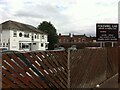
Foleshill Gas Club, Foleshill Road, Coventry
In his novel Invisible Cities, Italo Calvino tells of a city made of two halves, one of everyday working life, the other a fairground. After six months, the temporary half-city is taken down and moved to a new location. Workmen dismantle banks, factories and schools, load them onto lorries and leave the half-city of fairground rides behind.
So it is with Coventry: factories and industrial installations close, leaving their sports and social clubs behind as memorials: Alvis, Standard Triumph and, on Foleshill Road, the gasworks. The history of the gasworks can be read about here: https://www.geograph.org.uk/snippet/8825
Image: © A J Paxton
Taken: 31 Jul 2021
0.05 miles
4
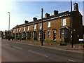
Terrace of houses, Foleshill Road, Coventry
This is a row of nine houses which look of late 19th century date. Very unusually for this area, they are built of hard brown sandstone, which suggests Bradford and the surrounding area of Yorkshire, rather than Coventry. The Ramgarhia gurdwara, built from the 1960s onwards, can be seen beyond them.
Image: © A J Paxton
Taken: 9 Oct 2021
0.06 miles
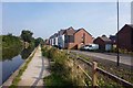
6
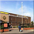
Ramgarhia Gurdwara, Foleshill Road, Coventry
The Ramgarhia Gurdwara is a Sikh temple (gurdwara) on a prominent site at 1103 Foleshill Road, further out of town than most other Coventry gurdwaras. Its website is here http://ramgarhiagurdwara.com/ , but has nothing to say about its history. It was founded in 1965, according to the Victoria County History of Warwickshire, Vol 8, pp396-397 https://www.british-history.ac.uk/vch/warks/vol8/pp396-397 . A brief TV news clip of the opening of the new building in 1969 can be seen here https://www.macearchive.org/films/midlands-news-07111969-opening-sikh-temple-coventry . The new structure shown in the news report is attached to a row of terraced houses, which have since been replaced as the gurdwara has been extended.
Image: © A J Paxton
Taken: 9 Oct 2021
0.07 miles
7
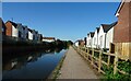
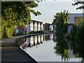
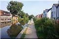
Coventry Canal
New housing close to the canal on both sides.
Image: © Anne Burgess
Taken: 23 Sep 2021
0.07 miles
8

Coventry Canal, Little Heath
A rather drab industrial stretch of the canal; at least the graffiti has some artistic pretensions.
Image: © Stephen McKay
Taken: 19 Oct 2008
0.08 miles
9
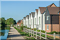
Philips Walk and Cordin View
Housing alongside the Coventry Canal dating from 2018 and 2019 respectively, built on the site of the former Courtaulds Acetate works.
Image: © Ian Capper
Taken: 23 Sep 2021
0.09 miles
10
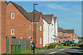
Cordin View
Housing alongside the Coventry Canal completed in 2019, built on the site of the former Courtaulds Acetate works.
Image: © Ian Capper
Taken: 23 Sep 2021
0.09 miles