IMAGES TAKEN NEAR TO
Lythalls Lane, COVENTRY, CV6 6FN
Introduction
This page details the photographs taken nearby to Lythalls Lane, CV6 6FN by members of the Geograph project.
The Geograph project started in 2005 with the aim of publishing, organising and preserving representative images for every square kilometre of Great Britain, Ireland and the Isle of Man.

There are currently over 7.5m images from over14,400 individuals and you can help contribute to the project by visiting https://www.geograph.org.uk
Image Map
Images are licensed for reuse under creativecommons.org/licenses/by-sa/2.0
Notes
- Clicking on the map will re-center to the selected point.
- The higher the marker number, the further away the image location is from the centre of the postcode.
Image Listing (28 Images Found)
Images are licensed for reuse under creativecommons.org/licenses/by-sa/2.0
Image
Details
Distance
1
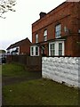
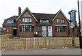
Former farm buildings, Lythalls Lane, Coventry
Buildings of a farm, marked on the OS 6-inch map of 1888-1913 as Hollybank Farm, now deep in the built-up area of Coventry. https://maps.nls.uk/geo/explore/side-by-side/#zoom=16&lat=52.43930&lon=-1.49834&layers=6&right=OSAPI The farmhouse is still used as housing while the building beyond it is part of a motor business.
Image: © A J Paxton
Taken: 21 May 2021
0.06 miles
2
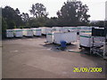
Portable toilets in Elliott Loohire depot
Image: © chris almond
Taken: 26 Sep 2008
0.06 miles
3
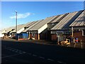
An unexpected watering hole
In among Coventry Centreless Grinding and suchlike workshops on the Lythalls Lane Industrial Estate can be found a craft brewery with a tap room, conveniently near to the football and rugby stadium. Its orange sign can be seen at the left hand side of this photo, on the last but one unit; it was founded in 2011 and its website is here https://www.byattsbrewery.co.uk/about/ .
The industrial estate stands on the site of a tram depot and the Foleshill Union Workhouse, as can be seen on the OS Six Inch 1888-1913 Series map https://maps.nls.uk/geo/explore/side-by-side/#zoom=16&lat=52.44003&lon=-1.49592&layers=6&right=osm
Image: © A J Paxton
Taken: 14 Jul 2022
0.07 miles
4
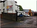
Hindu temple, Lythalls Lane, Coventry
Eellakkanthan Thirukkovil is a temple dedicated to Murugan (Kartikeya), a god of partcular importance to Tamil communities. https://www.ishtadevata.com/temple/eellakkanthan-thirukkovil-coventry-warwickshire/ https://en.wikipedia.org/wiki/Kartikeya
Image: © A J Paxton
Taken: 21 May 2021
0.11 miles
5
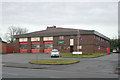
Foleshill fire station
Foleshill fire station, Foleshill Road, Coventry, West Midlands
Image: © Kevin Hale
Taken: 25 Jan 2009
0.12 miles
6
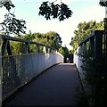
Footbridge from Foleshill to Holbrooks
This metal footbridge crosses the A444 Jimmy Hill Way, formerly known as Phoenix Way, which is the main road northwards out of Coventry and was constructed in the 1990s. The footbridge connects Beresford Road in Foleshill with Holbrook Primary School and with Lythalls Lane via Copper Beech Close.
Image: © A J Paxton
Taken: 14 Jul 2022
0.12 miles
7
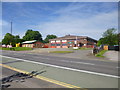
Foleshill Community Fire Station
On Foleshill Road, operated by West Midlands Fire Service: https://www.wmfs.net/content/foleshill-fire-station
Image: © Mike Faherty
Taken: 8 Jun 2014
0.12 miles
8
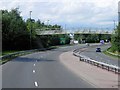
A444, Footbridge near Holbrook Primary School
Image: © David Dixon
Taken: 5 Aug 2013
0.13 miles
9
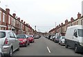
King George's Avenue heading to Lythalls Lane
Image: © Steve Daniels
Taken: 23 Mar 2019
0.14 miles