
IMAGES TAKEN NEAR TO
Foleshill Road, COVENTRY, CV6 6EN
Introduction
This page details the photographs taken nearby to Foleshill Road, CV6 6EN by members of the Geograph project.
The Geograph project started in 2005 with the aim of publishing, organising and preserving representative images for every square kilometre of Great Britain, Ireland and the Isle of Man.

There are currently over 7.5m images from over14,400 individuals and you can help contribute to the project by visiting https://www.geograph.org.uk
Image Map
Images are licensed for reuse under creativecommons.org/licenses/by-sa/2.0
Notes
- Clicking on the map will re-center to the selected point.
- The higher the marker number, the further away the image location is from the centre of the postcode.
Image Listing (63 Images Found)
Images are licensed for reuse under creativecommons.org/licenses/by-sa/2.0
Image
Details
Distance
1
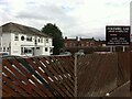
Foleshill Gas Club, Foleshill Road, Coventry
In his novel Invisible Cities, Italo Calvino tells of a city made of two halves, one of everyday working life, the other a fairground. After six months, the temporary half-city is taken down and moved to a new location. Workmen dismantle banks, factories and schools, load them onto lorries and leave the half-city of fairground rides behind.
So it is with Coventry: factories and industrial installations close, leaving their sports and social clubs behind as memorials: Alvis, Standard Triumph and, on Foleshill Road, the gasworks. The history of the gasworks can be read about here: https://www.geograph.org.uk/snippet/8825
Image: © A J Paxton
Taken: 31 Jul 2021
0.03 miles
2
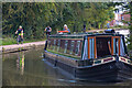
Coventry : Coventry Canal
A barge heads along the canal.
Image: © Lewis Clarke
Taken: 25 Sep 2021
0.04 miles
4
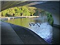
Bend in the Coventry Canal, with ducks
The bridge is bridge number 8, the New Inn Bridge .
Image: © Ruth Sharville
Taken: 23 Sep 2021
0.04 miles
5
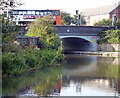
Bridge 8: New Inn Bridge
Carrying the B4113 Longford Road across the Coventry Canal.
Image: © Mat Fascione
Taken: 11 Sep 2014
0.04 miles
6
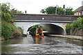
Coventry Canal - narrowboat
Passing under bridge 8 near the Arena Shopping Centre. The vessel is a diesel powered boat and was taking part in a Steamboat Association Rally on the Coventry Canal. it was heading for Hawkesbury junction.
Image: © Chris Allen
Taken: 22 Jun 2013
0.04 miles
8
![A stroll along the Coventry Canal to Hawkesbury Junction [34]](https://s3.geograph.org.uk/geophotos/07/12/19/7121955_c920103e_120x120.jpg)
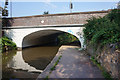
A stroll along the Coventry Canal to Hawkesbury Junction [34]
New Inn Bridge, number 8, carries Foleshill Road, B4113, over the canal.
The narrow canal was built to connect the city of Coventry with the Trent & Mersey Canal, some 38 miles distant, to exploit the Warwickshire coalfields. Construction of the canal took 20 years before it was complete in 1769. The canal between the basin in Coventry and Hawkesbury junction was made a conservation area in 2012.
Image: © Michael Dibb
Taken: 23 Sep 2021
0.05 miles
9
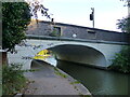
Bridge number 8, the New Inn Bridge, over the Coventry Canal
This bridge carries the Foleshill Road to the south, and Longford Road to the north.
Image: © Ruth Sharville
Taken: 23 Sep 2021
0.06 miles
10
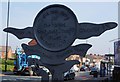
Mileage marker next to bridge #8, Coventry Canal
Image: © Ian S
Taken: 27 Aug 2019
0.06 miles