1
177 Grange Road, Birthplace of Tom Mann, Union Leader
Image: © Alex McGregor
Taken: 16 Jul 2014
0.02 miles
2
Pair of cottages on Grange Road, Longford
Pair of semi-detached cottages with facade in chequerboard brick, facing onto Grange Road in Longford, on the northern fringe of Coventry. The house on the right was the birthplace in 1856 of the trade unionist Tom Mann and the plaque to the right of the door records this. Mann had a long career as a union organiser in Britain and Australia and was a founder of the Communist Party of Great Britain in 1920. A collection of his papers is held in Coventry at Warwick University. https://mrc-catalogue.warwick.ac.uk/records/TMM
Image: © A J Paxton
Taken: 1 Jun 2021
0.02 miles
3
Grange Road
Turn of the 19th/20th Centuries terraced housing on Grange Road. The 1904 1:2,500 map, on which they are first shown, also shows the extension of the adjacent brickworks, with a tramway connecting the works with the Coventry Canal shown as running along the rear of the gardens behind the terrace, suggesting that the houses may have been built for brickmakers at the works. In the right background is the M6 motorway.
Image: © Ian Capper
Taken: 23 Sep 2021
0.05 miles
4
Under the pylons, Grange Road
Grange Road runs from Longford and Alderman's Green on the northern edge of Coventry over the canal to Hawkesbury. It is seen here from a gap in the fence of the Coventry Canal towpath. Truly an 'edgelands' landscape: pylons fanning out from the substation by the site of the coal-fired power station, a gantry over the M6 motorway just visible above the houses and trees at the centre right. To the right, Grange Farm, a vernacular farmhouse swallowed up by the city, to the left a row of late 19th century houses. The site in the foreground has been cleared for development, probably more housing.
Image: © A J Paxton
Taken: 1 Jun 2021
0.06 miles
5
New housing on Thomas Biddle Lane, seen from the Coventry Canal
New housing estate off Grange Road, Longford, seen through a gap in the hedge from the towpath of the canal.
Image: © A J Paxton
Taken: 1 Jun 2021
0.07 miles
6
M6 crosses Grange Road
Image: © Alex McGregor
Taken: 16 Jul 2014
0.09 miles
7
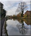
Coventry Canal next to Blackhorse Road Bridge No 11
Image: © Mat Fascione
Taken: 7 Nov 2020
0.09 miles
8
Coventry Canal, Hawkesbury
The vessel is the steam powered ice breaking narrowboat Laplander. The vessel is a 30' x 7' iceboat built c1830. The steam plant is a modern installation of c1980-86. The engine is a c1900 built inverted vertical single cylinder by W H Bailey of Salford and must have started life as a stationary engine. The cylinder is 3.5" x 7" and fitted with slip eccentric reverse. The boiler is a Clarkson 'thimble tube' boiler of c1960s vintage.
Image: © Chris Allen
Taken: 22 Jun 2013
0.09 miles
9
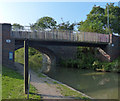
Bridge 11: Coney Lane Bridge
Two separate bridges, a road bridge and a footbridge, crossing the Coventry Canal at Hawkesbury.
Image: © Mat Fascione
Taken: 11 Sep 2014
0.10 miles
10
Under Black Horse Road Bridge No 11
Image: © Mat Fascione
Taken: 7 Nov 2020
0.10 miles


