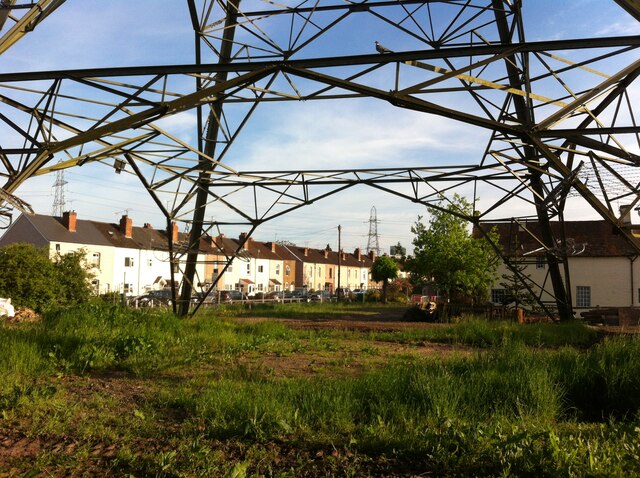
Under the pylons, Grange Road
Introduction
The photograph on this page of Under the pylons, Grange Road by A J Paxton as part of the Geograph project.
The Geograph project started in 2005 with the aim of publishing, organising and preserving representative images for every square kilometre of Great Britain, Ireland and the Isle of Man.
There are currently over 7.5m images from over 14,400 individuals and you can help contribute to the project by visiting https://www.geograph.org.uk

Image: © A J Paxton Taken: 1 Jun 2021
Grange Road runs from Longford and Alderman's Green on the northern edge of Coventry over the canal to Hawkesbury. It is seen here from a gap in the fence of the Coventry Canal towpath. Truly an 'edgelands' landscape: pylons fanning out from the substation by the site of the coal-fired power station, a gantry over the M6 motorway just visible above the houses and trees at the centre right. To the right, Grange Farm, a vernacular farmhouse swallowed up by the city, to the left a row of late 19th century houses. The site in the foreground has been cleared for development, probably more housing.

