
IMAGES TAKEN NEAR TO
Mirpur Close, COVENTRY, CV6 5QP
Introduction
This page details the photographs taken nearby to Mirpur Close, CV6 5QP by members of the Geograph project.
The Geograph project started in 2005 with the aim of publishing, organising and preserving representative images for every square kilometre of Great Britain, Ireland and the Isle of Man.

There are currently over 7.5m images from over14,400 individuals and you can help contribute to the project by visiting https://www.geograph.org.uk
Image Map
Images are licensed for reuse under creativecommons.org/licenses/by-sa/2.0
Notes
- Clicking on the map will re-center to the selected point.
- The higher the marker number, the further away the image location is from the centre of the postcode.
Image Listing (158 Images Found)
Images are licensed for reuse under creativecommons.org/licenses/by-sa/2.0
Image
Details
Distance
1
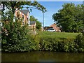
New housing alongside the Coventry Canal
Very recently completed when photographed in September 2021. The area was previously occupied by the Midland Brick and Tile Works.
Image: © Alan Murray-Rust
Taken: 23 Sep 2021
0.04 miles
2
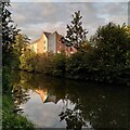
Apartments reflected in the Coventry Canal, Foleshill
This apartment block, reflected in the waters of the canal at sunset, was built in the 2010s on part of the site of Webster's brick & tile works. The slightly-cracked sounding bell of the Hindu temple on George Eliot Road was ringing out - but Geograph doesn't do audio...
Image: © A J Paxton
Taken: 1 Sep 2023
0.05 miles
3
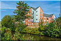
Brooklyn House
Apartment block in Owens Road, overlooking the Coventry Canal, completed in 2020. The land had previously been part of the Courtaulds site in the 20th Century and a brickworks before that.
Image: © Ian Capper
Taken: 23 Sep 2021
0.05 miles
5
![A stroll along the Coventry Canal to Hawkesbury Junction [4]](https://s1.geograph.org.uk/geophotos/07/12/11/7121117_b8aee4df_120x120.jpg)
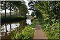
A stroll along the Coventry Canal to Hawkesbury Junction [4]
New building work on Owens Road. The building will be Brooklyn House.
The narrow canal was built to connect the city of Coventry with the Trent & Mersey Canal, some 38 miles distant, to exploit the Warwickshire coalfields. Construction of the canal took 20 years before it was complete in 1769. The canal between the basin in Coventry and Hawkesbury junction was made a conservation area in 2012.
Image: © Michael Dibb
Taken: 23 Sep 2021
0.06 miles
6
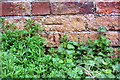
Benchmark on wall beside Coventry Canal
Ordnance Survey cut mark benchmark described on the Bench Mark Database at www.bench-marks.org.uk/bm112014
Image: © Luke Shaw
Taken: 4 Apr 2018
0.07 miles
7
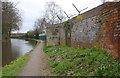
View along the Coventry Canal
There is an OS benchmark Image on the brick wall near the right hand edge of the image
Image: © Luke Shaw
Taken: 4 Apr 2018
0.07 miles

10
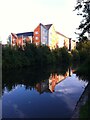
Apartment block reflected in the waters of the Coventry Canal
The apartment block is part of a development built recently (2020-21) on part of the site of Webster's brick & tile works.
Image: © A J Paxton
Taken: 16 Aug 2021
0.10 miles