
IMAGES TAKEN NEAR TO
Kingfield Road, COVENTRY, CV6 5PQ
Introduction
This page details the photographs taken nearby to Kingfield Road, CV6 5PQ by members of the Geograph project.
The Geograph project started in 2005 with the aim of publishing, organising and preserving representative images for every square kilometre of Great Britain, Ireland and the Isle of Man.

There are currently over 7.5m images from over14,400 individuals and you can help contribute to the project by visiting https://www.geograph.org.uk
Image Map
Images are licensed for reuse under creativecommons.org/licenses/by-sa/2.0
Notes
- Clicking on the map will re-center to the selected point.
- The higher the marker number, the further away the image location is from the centre of the postcode.
Image Listing (18 Images Found)
Images are licensed for reuse under creativecommons.org/licenses/by-sa/2.0
Image
Details
Distance
1
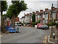
Kingfield Road, Coventry
Taken from the junction with Marion Road. The land on the left hand side is being redeveloped for housing and has been given the twee name 'Swallowcroft' by the builder.
Image: © Stephen McKay
Taken: 11 Aug 2006
0.06 miles
2
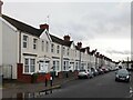
Former Coventry Corporation housing, Guild Road
These are some of the earliest council houses in Coventry, built by the city some time between 1907 and 1912. The very first row, on Pridmore Road, can be seen at the end of the street, on the right hand side of the photo, and also on this Geograph Image], which provides more information.
Image: © A J Paxton
Taken: 14 Jan 2023
0.08 miles
3
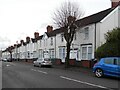
Former Coventry Corporation housing, Pridmore Road
These council houses were the first to be built in Coventry, in 1907. More followed soon after on neighbouring streets laid out by Narrow Lane (today Kingfield Road), and by 1912 over two hundred houses had been built by the city in this area. They were much needed at a time when the rapid industrial expansion of Coventry had led to an influx of workers and their families and housing was scarce. See David Fry & Albert Smith, The Coventry we have Lost: Forgotten Foleshill, Simanda Press, 2018, p27.
At the end of the 20th century the city's remaining housing stock was sold to a housing association. Many of the homes are now privately owned, but the uniform appearance of these suggests that they are still social housing. They are brick-built but have been covered with insulating cladding some time early in the 21st century, like these flats in Willenhall Image
Image: © A J Paxton
Taken: 14 Jan 2023
0.12 miles
4
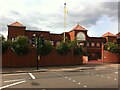
Ajit Darbar Sikh Temple, Lockhurst Lane, Foleshill
This gurdwara is dated 1962 on the front but the current building is clearly much more recent than that.
Image: © A J Paxton
Taken: 11 Sep 2021
0.17 miles
5
![A stroll along the Coventry Canal to Hawkesbury Junction [2]](https://s3.geograph.org.uk/geophotos/07/12/11/7121115_46f4adf4_120x120.jpg)
A stroll along the Coventry Canal to Hawkesbury Junction [2]
Now festooned with communication transmitters is the base of a former chimney, part of the former Courtaulds textiles site. Part of the site is now the Foleshill Enterprise Park.
The narrow canal was built to connect the city of Coventry with the Trent & Mersey Canal, some 38 miles distant, to exploit the Warwickshire coalfields. Construction of the canal took 20 years before it was complete in 1769. The canal between the basin in Coventry and Hawkesbury junction was made a conservation area in 2012.
Image: © Michael Dibb
Taken: 23 Sep 2021
0.19 miles
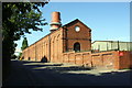
7
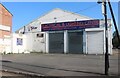
DSK electrical and lighting centre on Livingstone Road, Coventry
Image: © David Howard
Taken: 21 May 2023
0.20 miles
8
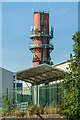
Former Courtaulds chimney
The base of a former chimney in the extensive Courtaulds textiles site, with part of Foleshill Enterprise Park, which now occupies part of the site, in the foreground.
Image: © Ian Capper
Taken: 23 Sep 2021
0.20 miles
9
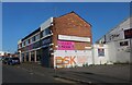
Tattoo parlour on Livingstone Road, Coventry
Image: © David Howard
Taken: 21 May 2023
0.21 miles
10
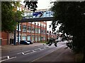
Former Courtaulds factory, Lockhurst Lane, Foleshill
The Lockhurst Lane 'bridge of sighs' connects two parts of Courtaulds textile works, which expanded along Lockhurst Lane in the years after 1918. The factory, which was known for making rayon and similar artificial fibres, closed in the 1990s and the surviving buildings have been put to a variety of commercial uses, with some converted to housing.
Image: © A J Paxton
Taken: 11 Sep 2021
0.21 miles