1
Coventry-Paradise Foleshill
The Shree Mandhata Samaj Community Centre. Established in 1978 in a converted Primitive Methodist School. Paradise is an area of Foleshill.
Image: © Ian Rob
Taken: 9 Jan 2008
0.01 miles
2
Shree Mandhata Samaj Hindu community hall, Cross Road, Foleshill
The community hall occupies a former Primitive Methodist School of 1907, as can be seen from the inscriptions on the facade; there is also a large cross indelibly incorporated in the brickwork, standing out in relief. Paradise Primitive Methodist Chapel (Paradise is the name of the district) was first built in 1828, was rebuilt in 1865, and the Sunday school was built alongside it. The chapel has since been demolished. See Fry, D & Smith, A, The Coventry we have lost: Forgotten Foleshill, Simanda Press, 2018, p97.
According to its website, Shree Mandhata Samaj UK is an association of Koli Patels, a jati or caste originally from Navsari District in Gujarat, India. Many members subsequently emigrated to East Africa, where they adopted the name Mandhata Samaj for their community. They retained it when they moved later to Britain and other countries as political conditions became difficult for them in East Africa. https://www.amsuk.org/about-us/
Image: © A J Paxton
Taken: 26 Aug 2021
0.04 miles
3
Overgrown plot, Stoney Stanton Road, Foleshill
This plot of land, fenced off from the road, is an unexpected patch of green in a very built-up area. On the far side can be seen the windowless wall of a workshop that is dated 1850 on the gable end that faces the road; a cottage stands next to it, and can be seen beyond and to the left of the workshop.
Image: © A J Paxton
Taken: 26 Aug 2021
0.04 miles
4
Coventry-Gurdwara Sri Guru Singh Sabha
Sikh Temple in Cross Road.
Image: © Ian Rob
Taken: 24 Feb 2014
0.08 miles
5
Coventry Canal
The low winter sun casts a shadow on the canal. Looking from Navigation Bridge.
Image: © Ian Rob
Taken: 9 Jan 2011
0.08 miles
6
Danger unguarded canal !
There are several of these signs along the edge of the car park at the Gallagher Retail Park. The Coventry Canal is immediately behind, and several feet below the shrubbery.
Image: © E Gammie
Taken: 23 Aug 2006
0.09 miles
7
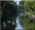
Swans on the Coventry Canal
Next to Bridge 6: Navigation Bridge.
Image: © Mat Fascione
Taken: 11 Sep 2014
0.09 miles
8
Bridge 6: Navigation Bridge
Crossing the Coventry Canal in Coventry.
Image: © Mat Fascione
Taken: 11 Sep 2014
0.10 miles
9
Gallagher Retail Park
On the former Alfred Herberts factory site, off Stoney Stanton Road.
Image: © E Gammie
Taken: 23 Aug 2006
0.11 miles
10
Paradise House sign and detail of tower block
“In my Father's house are many mansions: if it were not so, I would have told you. I go to prepare a place for you.” (John 14:2, King James Version). https://www.kingjamesbibleonline.org/John-14-2/ A block of Coventry council housing on Eden Street may not be what was intended here. This block of 58 flats in 10 storeys was constructed by Wimpey for Coventry County Borough Council between 1961 & 1962. https://www.towerblock.eca.ed.ac.uk/development/eden-street Nearby is the Adam & Eve pub.
Image: © A J Paxton
Taken: 21 May 2014
0.12 miles


