
IMAGES TAKEN NEAR TO
Caldecote Road, COVENTRY, CV6 3GA
Introduction
This page details the photographs taken nearby to Caldecote Road, CV6 3GA by members of the Geograph project.
The Geograph project started in 2005 with the aim of publishing, organising and preserving representative images for every square kilometre of Great Britain, Ireland and the Isle of Man.

There are currently over 7.5m images from over14,400 individuals and you can help contribute to the project by visiting https://www.geograph.org.uk
Image Map
Images are licensed for reuse under creativecommons.org/licenses/by-sa/2.0
Notes
- Clicking on the map will re-center to the selected point.
- The higher the marker number, the further away the image location is from the centre of the postcode.
Image Listing (80 Images Found)
Images are licensed for reuse under creativecommons.org/licenses/by-sa/2.0
Image
Details
Distance
2
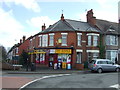
Off licence and houses at north end of Sandy Lane
Image: © Roger Templeman
Taken: 10 Jul 2018
0.04 miles
4
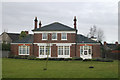
Radford fire station
Radford old fire station, Chetton Avenue, Daimler Green, Radford, Coventry, West Midlands. Now used as a children's nursery
Image: © Kevin Hale
Taken: 25 Jan 2009
0.08 miles
5
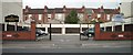
Widdrington Court private car park on Widdrington Road
This site used to house a garage and small petrol station. You can see where the pavement has been lowered for cars to enter and leave the forecourt of the former petrol station. The houses in the background are in Somerset Road.
Image: © starkderrick
Taken: 10 Oct 2011
0.16 miles
6

Cheveral Avenue
These are terraced houses at the southern end of Cheveral Avenue close to its junction with Middlemarch Rd.
Image: © Nigel Mykura
Taken: 13 Aug 2010
0.16 miles
8
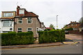
#16 Lydgate Road at Tulliver Street junction
Image: © Roger Templeman
Taken: 30 Apr 2018
0.17 miles
9
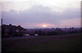
Radford Common
Land on the common is at 100m above sea level and drops away westward. To the left is Sandhurst Grove with short-terraced 1930's bay windowed houses typical of several of Coventry's suburbs.
Image: © FCG
Taken: Unknown
0.18 miles
10
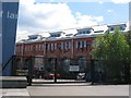
Turbine building Electric Wharf
The converted turbine house of Coventry's Victorian electric power station at Electric Wharf, viewed from the Sandy Lane side.
Image: © E Gammie
Taken: 12 May 2012
0.19 miles