
IMAGES TAKEN NEAR TO
Halford Lane, COVENTRY, CV6 2HF
Introduction
This page details the photographs taken nearby to Halford Lane, CV6 2HF by members of the Geograph project.
The Geograph project started in 2005 with the aim of publishing, organising and preserving representative images for every square kilometre of Great Britain, Ireland and the Isle of Man.

There are currently over 7.5m images from over14,400 individuals and you can help contribute to the project by visiting https://www.geograph.org.uk
Image Map
Images are licensed for reuse under creativecommons.org/licenses/by-sa/2.0
Notes
- Clicking on the map will re-center to the selected point.
- The higher the marker number, the further away the image location is from the centre of the postcode.
Image Listing (31 Images Found)
Images are licensed for reuse under creativecommons.org/licenses/by-sa/2.0
Image
Details
Distance
3
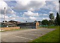
Keresley, primary school
Whitmore Park Primary School, on Halford Lane. Development seems to be taking place: http://www.whitmorepark.co.uk/AboutOurSchool.shtml
Image: © Mike Faherty
Taken: 7 Jun 2014
0.09 miles
8
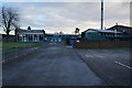
Coventry : Rylston Avenue
Looking along Rylston Avenue off Beake Avenue.
Image: © Lewis Clarke
Taken: 25 Sep 2021
0.15 miles
9
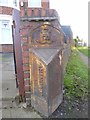
Old Boundary Marker by Sasler Road, Coventry Parish
Parish Boundary Marker by the UC road, in parish of Coventry (Coventry District), in front of no.315 on the west side of Sadler Road. The wall in the photo has since been removed.
Surveyed
Milestone Society National ID: WA_COVKE04pb
Image: © M Faherty
Taken: 1 Feb 2015
0.17 miles
10
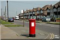
Pillar Box at the junction of Beake Avenue and Rylston Avenue
Rylston Avenue was once on the boundary of the city. It now stands some distance inside. Beake Avenue is a well established, fairly typical Coventry residential road
Image: © Dave and Vicky
Taken: 24 Apr 2005
0.17 miles