
IMAGES TAKEN NEAR TO
Watery Lane, COVENTRY, CV6 2GE
Introduction
This page details the photographs taken nearby to Watery Lane, CV6 2GE by members of the Geograph project.
The Geograph project started in 2005 with the aim of publishing, organising and preserving representative images for every square kilometre of Great Britain, Ireland and the Isle of Man.

There are currently over 7.5m images from over14,400 individuals and you can help contribute to the project by visiting https://www.geograph.org.uk
Image Map
Images are licensed for reuse under creativecommons.org/licenses/by-sa/2.0
Notes
- Clicking on the map will re-center to the selected point.
- The higher the marker number, the further away the image location is from the centre of the postcode.
Image Listing (26 Images Found)
Images are licensed for reuse under creativecommons.org/licenses/by-sa/2.0
Image
Details
Distance
1
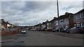
Edward Road, Keresley
Local authority housing typical of this area.
Image: © Peter Mackenzie
Taken: 29 Dec 2018
0.09 miles
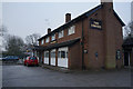
3
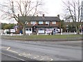
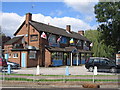
Keresley, The Convoy
Pub at the corner of Penny Park Lane and Watery Lane; unfortunately closed at my visit, so I was not able to inspect the interior.
Image: © Mike Faherty
Taken: 6 Feb 2015
0.09 miles

5
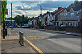
Coventry : Nunts Lane
Looking along Nunts Lane.
Image: © Lewis Clarke
Taken: 25 Sep 2021
0.11 miles
8
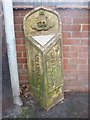
Old Boundary Marker by Parkgate Road, Coventry
Parish Boundary Marker by the UC road, in parish of Coventry (Coventry District), against the wall of Holy Family church on the south side of the junction of Parkgate Road and Nunts Lane.
Inscription reads vertically:-
: CITY OF / COVENTRY : : {crest} : : COUNTY OF / WARWICK / PARISH OF / KERESLEY :
Surveyed
Milestone Society National ID: WA_COVKE05pb
Image: © M Faherty
Taken: 6 Feb 2015
0.13 miles
9
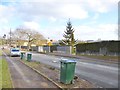
Keresley, Holy Family School
Screened behind hedges on Beake Avenue: http://www.holyfamily.coventry.sch.uk/
Image: © Mike Faherty
Taken: 6 Feb 2015
0.13 miles
10
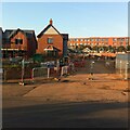
New housing, Watery Lane, Holbrooks
Housing developments are now filling in the gaps in the built-up area around Holbrooks and Keresley. This one on Watery Lane has been called 'Jubilee Green' by the developer. Behind it can be seen part of President Kennedy school.
Image: © A J Paxton
Taken: 9 Aug 2022
0.14 miles