
IMAGES TAKEN NEAR TO
Beche Way, COVENTRY, CV5 9NW
Introduction
This page details the photographs taken nearby to Beche Way, CV5 9NW by members of the Geograph project.
The Geograph project started in 2005 with the aim of publishing, organising and preserving representative images for every square kilometre of Great Britain, Ireland and the Isle of Man.

There are currently over 7.5m images from over14,400 individuals and you can help contribute to the project by visiting https://www.geograph.org.uk
Image Map
Images are licensed for reuse under creativecommons.org/licenses/by-sa/2.0
Notes
- Clicking on the map will re-center to the selected point.
- The higher the marker number, the further away the image location is from the centre of the postcode.
Image Listing (83 Images Found)
Images are licensed for reuse under creativecommons.org/licenses/by-sa/2.0
Image
Details
Distance
1
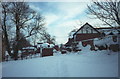
Buildings by Allesley Hall
In Allesley Park on Sunday 9th December 1990, the morning after a major snowfall. The building in the centre with a conical roof is the 200 year old dovecote.
See also: http://www.geograph.org.uk/photo/358741
Image: © E Gammie
Taken: 9 Dec 1990
0.04 miles
2
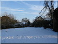
Buildings near Allesley Hall
Allesley Hall on the left is now a residential care home and the buildings on the right are sheltered housing. In the centre is the cylindrical dovecote.
Also 1990: http://www.geograph.org.uk/photo/1074696
and 2007: http://www.geograph.org.uk/photo/358741
Image: © E Gammie
Taken: 9 Jan 2010
0.04 miles
3
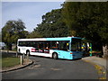
Bus in Allesley Park turning circle
A bus rests in the turning circle on Winsford Avenue, Allesley Park, adjacent to an entrance to the park that lends its name to the housing development.
Image: © Richard Vince
Taken: 4 Oct 2011
0.04 miles
4
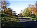
Allesley Hall Drive
Allesley Hall, seen from Allesley Hall Drive.
Image: © E Gammie
Taken: 19 Nov 2006
0.04 miles
5
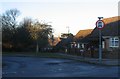
Beche Way, Allesley Park
The footpath at Beche Way by the bus turning point on Allesley Park estate leads down to the public park. The spire of Allesley's All Saints church in SP3080 can be glimpsed between the trees.
Image: © E Gammie
Taken: 3 Dec 2008
0.05 miles
6
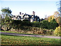
Allesley Hall
This Hall, now a nursing home, was built on the site of a previous mansion in about 1910. Stonehouse Lane, in the foreground, leads to Allesley Village, joining the Birmingham Road by the Stone House Image
A 1979 view: Image]
Image: © E Gammie
Taken: 19 Nov 2006
0.05 miles
7
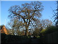
Allesley Park
A tree at the corner of Allesley Hall nursing home viewed from the footpath leading to the car park.
Image: © E Gammie
Taken: 18 Dec 2011
0.05 miles
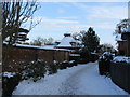
9
Dovecote, Allesley Park
In the centre is the conical roof of the dovecote, approximately 200 years old and now blocked to keep birds out. To the left is Allesley Hall Image Taken from near the walled garden Image
Image: © E Gammie
Taken: 8 Mar 2007
0.05 miles
10
Allesley Park walled garden, east gate
This part of the garden suffers from the glowering presence of the ornamental conifers, but their shade doesn't quite reach the kitchen garden area.
The garden was created about 200 years ago to provide fruit and vegetables for Allesley Hall and at one time produced exotic fruits within its 1.4 acres. It was converted to an ornamental garden in the 20th century before being neglected but is now being restored as a kitchen garden by a group of volunteers.
Image: © E Gammie
Taken: 29 Sep 2009
0.06 miles