
IMAGES TAKEN NEAR TO
Pangfield Park, COVENTRY, CV5 9NL
Introduction
This page details the photographs taken nearby to Pangfield Park, CV5 9NL by members of the Geograph project.
The Geograph project started in 2005 with the aim of publishing, organising and preserving representative images for every square kilometre of Great Britain, Ireland and the Isle of Man.

There are currently over 7.5m images from over14,400 individuals and you can help contribute to the project by visiting https://www.geograph.org.uk
Image Map
Images are licensed for reuse under creativecommons.org/licenses/by-sa/2.0
Notes
- Clicking on the map will re-center to the selected point.
- The higher the marker number, the further away the image location is from the centre of the postcode.
Image Listing (68 Images Found)
Images are licensed for reuse under creativecommons.org/licenses/by-sa/2.0
Image
Details
Distance
1
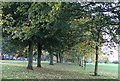
Allesley Hall Drive
Looking towards Allesley Hall along the avenue of trees flanking the drive, which is to the left of the photo. The avenue was of elms until the 1970s when they were hit by Dutch Elm Disease and had to be removed.
Image: © E Gammie
Taken: 29 Oct 2006
0.02 miles
2
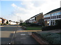
Pangfield Park
The houses on the right have jettied upper storeys. Part of the 1960s Allesley Park estate.
Image: © E Gammie
Taken: 30 Jan 2012
0.02 miles
3

Houses on Allesley Hall Drive
Houses of varying shapes and sizes bordering the drive on the northern edge of the 1960s-built Allesley Park estate have an open view across the park towards Coundon Wedge.
Image: © E Gammie
Taken: 30 Jan 2012
0.04 miles
4
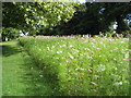
Allesley Hall Drive
A flower mix sown by the council in the spring has bloomed. The main effect at the moment is pink with most of the plants currently in flower being cosmos. The mix includes cornflowers, poppies, fairy toadflax, larkspur, cosmos and marigolds amongst others.
Image: © E Gammie
Taken: 17 Aug 2014
0.05 miles
5

Allesley Hall Drive in the pink
Looking across a bank of cosmos towards houses on the far side of Allesley Hall Drive. The display is a result of a springtime sowing by the council of a seed mix of cornflowers, poppies, fairy toadflax, larkspur, cosmos and marigolds amongst others.
Image: © E Gammie
Taken: 17 Aug 2014
0.06 miles
6
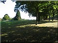
Allesley Hall Drive
Looking along the avenue of trees alongside Allesley Hall Drive and across the 9-hole golf course in Allesley Park. Visible on the centre horizon are the outlines of high-rise flats in the city centre (SP3379).
Image: © E Gammie
Taken: 29 Sep 2009
0.07 miles
7
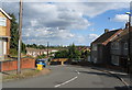
Torbay Road, Allesley Park estate
The tower blocks in the distance are office and residential blocks in the city centre.
Image: © E Gammie
Taken: 17 Aug 2014
0.09 miles
8
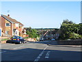
Torbay Road, Allesley Park
Torbay Road on a sunny day. Unfortunately, nowhere near Torbay or any bay. The road drops away steeply with a 10 percent gradient on a double bend. Woodland on Hearsall Common can be seen in the distance, above the rooftops.
Image: © E Gammie
Taken: 7 Aug 2016
0.09 miles
9
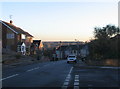
Torbay Road, Allesley Park
Torbay Road drops suddenly away. Warning signs for 10% hill and bends. Ice on the pavements on a road that catches little sun in winter. Have fun.
The trees on the horizon are on Hearsall Common in SP3078.
Image: © E Gammie
Taken: 3 Dec 2008
0.10 miles
10

Allesley Hall Drive
Looking away from the hall towards the junction with Allesley Old Road.
Image: © E Gammie
Taken: 2 Nov 2006
0.10 miles