
IMAGES TAKEN NEAR TO
Park Court, COVENTRY, CV5 9GS
Introduction
This page details the photographs taken nearby to Park Court, CV5 9GS by members of the Geograph project.
The Geograph project started in 2005 with the aim of publishing, organising and preserving representative images for every square kilometre of Great Britain, Ireland and the Isle of Man.

There are currently over 7.5m images from over14,400 individuals and you can help contribute to the project by visiting https://www.geograph.org.uk
Image Map
Images are licensed for reuse under creativecommons.org/licenses/by-sa/2.0
Notes
- Clicking on the map will re-center to the selected point.
- The higher the marker number, the further away the image location is from the centre of the postcode.
Image Listing (54 Images Found)
Images are licensed for reuse under creativecommons.org/licenses/by-sa/2.0
Image
Details
Distance
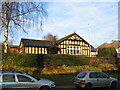
2
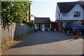
Allesley Post Office
Birmingham Road, Allesley.
Image: © Ian S
Taken: 26 Aug 2019
0.05 miles
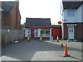
4
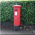
George V postbox on Birmingham Road, Allesley
Outside the Post Office.
Postbox No. CV5 33.
Image: © JThomas
Taken: 4 Mar 2017
0.05 miles
5
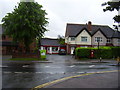
Allesley village Post Office
Still serving the community in Birmingham Road.
Image: © Anthony Vosper
Taken: 8 Jun 2012
0.06 miles
6
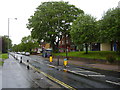
Flaming June!
The village shops in Birmingham road, Allesley.
This was once the main route from Coventry to Birmingham.
Another wet day in Jubilee week.
Image: © Anthony Vosper
Taken: 8 Jun 2012
0.08 miles
7
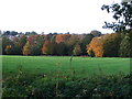
Autumn colour at Allesley Park
Looking towards Allesley village at the trees screening Pickford Way. Ridge and furrow markings visible in the field.
Image: © E Gammie
Taken: 29 Oct 2006
0.12 miles
8
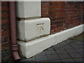
Bench mark on 87 Birmingham Road
This bench mark was established in 1848 during the First primary levelling of England & Wales, and was levelled with a height of 340.9270 feet [103.9145 metres] above mean sea level (Liverpool datum). It was included on the Birmingham to London levelling line. The surveyor's description was "No. 48. Bolt in East corner of the White Lion Inn, at South side of road, Allesley." (Public Abstract p.221). The White Lion is now a private house: 87 Birmingham Road.
Image: © Shantavira
Taken: 7 Feb 2015
0.12 miles
9
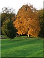
Silver birch
Some trees just like showing off in the autumn! Silver birch in Allesley Park, with ridge and furrow markings in foreground.
Image: © E Gammie
Taken: 29 Oct 2006
0.12 miles
10
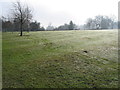
Ridge and furrow markings, Allesley Park
Remnants of morning mist and a heavy dew on the grass.
Image: © E Gammie
Taken: 1 Mar 2012
0.13 miles