
IMAGES TAKEN NEAR TO
Harvey Close, COVENTRY, CV5 9FU
Introduction
This page details the photographs taken nearby to Harvey Close, CV5 9FU by members of the Geograph project.
The Geograph project started in 2005 with the aim of publishing, organising and preserving representative images for every square kilometre of Great Britain, Ireland and the Isle of Man.

There are currently over 7.5m images from over14,400 individuals and you can help contribute to the project by visiting https://www.geograph.org.uk
Image Map
Images are licensed for reuse under creativecommons.org/licenses/by-sa/2.0
Notes
- Clicking on the map will re-center to the selected point.
- The higher the marker number, the further away the image location is from the centre of the postcode.
Image Listing (32 Images Found)
Images are licensed for reuse under creativecommons.org/licenses/by-sa/2.0
Image
Details
Distance
3
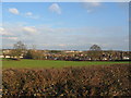
Towards Browns Lane
The backs of houses on Browns Lane and the former Jaguar factory site beyond Browns Lane.
Image: © E Gammie
Taken: 30 Jan 2012
0.10 miles
4
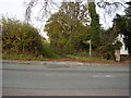
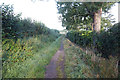
Footpath on The Windmill Hill
This path will take you across the fields to the Gables Trig point.
Image: © Anthony Vosper
Taken: 29 Oct 2009
0.10 miles
5
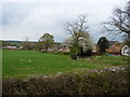
The back of the houses on Windmill Lane
Houses backing onto farmland in Allesley.
Image: © Richard Law
Taken: 14 Apr 2011
0.10 miles
7
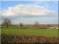
Farmland near Allesley
Winter crops in the fields and, to the right, houses on Washbrook Lane. On the centre skyline, between the two trees, are the trees on Church Lane, Corley in SP2985 ( http://www.geograph.org.uk/photo/2161578 ).
Image: © E Gammie
Taken: 30 Jan 2012
0.15 miles
8
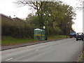
Bus Stop on a hill
A covered shelter on The Windmill Hill.
Image: © Anthony Vosper
Taken: 29 Oct 2009
0.16 miles
9
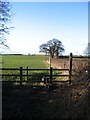
Stile and hedgerow, Allesley
The start of the footpath, which follows the hedgerow, from Windmill Hill towards Pickford. The stiles on this path are of an 'in-line' type rather than on the diagonal (there is the alternative of a muddy gateway to the left of this stile).
Image: © E Gammie
Taken: 11 Feb 2007
0.16 miles
10
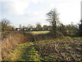
Footpath near Windmill Hill
Houses on Windmill Hill and a somewhat overgrown stile, the gateway to the right being used in preference.
Image: © E Gammie
Taken: 30 Jan 2012
0.17 miles