
IMAGES TAKEN NEAR TO
Henderson Close, COVENTRY, CV5 9EY
Introduction
This page details the photographs taken nearby to Henderson Close, CV5 9EY by members of the Geograph project.
The Geograph project started in 2005 with the aim of publishing, organising and preserving representative images for every square kilometre of Great Britain, Ireland and the Isle of Man.

There are currently over 7.5m images from over14,400 individuals and you can help contribute to the project by visiting https://www.geograph.org.uk
Image Map
Images are licensed for reuse under creativecommons.org/licenses/by-sa/2.0
Notes
- Clicking on the map will re-center to the selected point.
- The higher the marker number, the further away the image location is from the centre of the postcode.
Image Listing (13 Images Found)
Images are licensed for reuse under creativecommons.org/licenses/by-sa/2.0
Image
Details
Distance
1
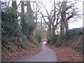
Staircase Lane, towards Allesley
Winding downhill to cross the Sherbourne at the bottom, the lane here is cut down to below the level of the surrounding fields. The underlying sandstone rock outcrops on the left.
Staircase Lane is an undulating curving lane that runs from Allesley village to join Northbrook Road between Coundon and Brownshill Green. The two roads are both cut off by the Coundon Wedge road and are now mainly used by pedestrians and cyclists.
Image: © E Gammie
Taken: 6 Jan 2008
0.09 miles
2
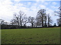
Trees bordering Staircase Lane
Twentieth century housing in Allesley village in the background.
Image: © E Gammie
Taken: 6 Jan 2008
0.12 miles
3
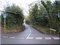
Staircase Lane Allesley
A typical Midlands narrow country lane.
Image: © Anthony Vosper
Taken: 14 Feb 2015
0.14 miles
4
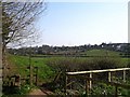
Footpath between Jaguar and Townfields
Looking towards the edge of Allesley at the allotments, centre and Butt Lane, right. Taken from the permissive footpath which runs between the nearly-defunct Jaguar plant (off to the left) and Townfields ( Image off to the right). The footpath is marked on 1977 editions (Pathfinder) of 1:25,000 Ordnance Survey. From here, it goes to the right, crosses the Sherbourne via a small wooden footbridge (visible, with no associated footpath, on the current 1:25,000 OS), then joins Butt Lane via a stile.
Image: © E Gammie
Taken: 1 Apr 2007
0.16 miles
5
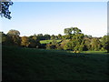
Sherbourne valley
Looking across the valley of the River Sherbourne (stream, really) near Allesley village.
Image: © E Gammie
Taken: 2 Nov 2006
0.17 miles
6
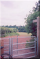
Footpath, Allesley
The entrance from Staircase Lane to the footpath, running south to Allesley, which joins Church Walk at Image The spire of Allesley church Image can be seen on the horizon.
Image: © E Gammie
Taken: 11 Jun 2006
0.18 miles
7
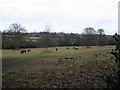
Horses grazing, Sherbourne Valley
The river Sherbourne runs along the bottom of the field.
Image: © E Gammie
Taken: 6 Jan 2008
0.18 miles
8
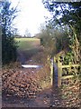
Wooden footbridge
Crossing the River Sherbourne. The footpath follows the fence boundary on the right and exits, via a metal kissing gate at the top of the field, onto Staircase Lane.
Image: © E Gammie
Taken: 6 Jan 2008
0.18 miles
9
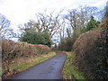
Staircase Lane by Church Farm
Staircase Lane is an undulating curving lane that runs from Allesley village to join Northbrook Road between Coundon and Brownshill Green. The two roads are both cut off by the Coundon Wedge road and are now mainly used by pedestrians and cyclists.
Image: © E Gammie
Taken: 6 Jan 2008
0.20 miles
10
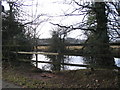
Pond by Staircase Lane
Allesley village in the background. Staircase Lane is an undulating curving lane that runs from Allesley village to join Northbrook Road between Coundon and Brownshill Green. The two roads are both cut off by the Coundon Wedge Road and are now mainly used by pedestrians and cyclists.
Image: © E Gammie
Taken: 6 Jan 2008
0.21 miles