
IMAGES TAKEN NEAR TO
Clay Lane, COVENTRY, CV5 9DG
Introduction
This page details the photographs taken nearby to Clay Lane, CV5 9DG by members of the Geograph project.
The Geograph project started in 2005 with the aim of publishing, organising and preserving representative images for every square kilometre of Great Britain, Ireland and the Isle of Man.

There are currently over 7.5m images from over14,400 individuals and you can help contribute to the project by visiting https://www.geograph.org.uk
Image Map
Images are licensed for reuse under creativecommons.org/licenses/by-sa/2.0
Notes
- Clicking on the map will re-center to the selected point.
- The higher the marker number, the further away the image location is from the centre of the postcode.
Image Listing (20 Images Found)
Images are licensed for reuse under creativecommons.org/licenses/by-sa/2.0
Image
Details
Distance
1
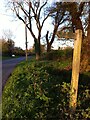
Signpost pointing to Elkin Wood
Signpost on verge at junction of Oak Lane with Clay Lane, pointing up Clay Lane to Elkin Wood, an ancient woodland belonging to the Woodland Trust that is accessible to the public.
Image: © A J Paxton
Taken: 7 May 2021
0.02 miles
2
Approaching Hawkes End
Hawkes End is a scattered Green Belt community within Allesley parish, to the north-west of Coventry
Image: © Jonathan Billinger
Taken: 7 Feb 2017
0.02 miles
3
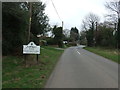
Entering Hawkes End
Looking east on Oak Lane.
Image: © JThomas
Taken: 11 Mar 2017
0.03 miles
4
Clay Lane
Heads north-west towards Corley Moor.
Image: © Jonathan Billinger
Taken: 7 Feb 2017
0.04 miles

6

Oak Lane
Towards Meriden from Allesley.
Image: © Jonathan Billinger
Taken: 7 Feb 2017
0.05 miles
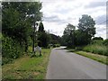
8
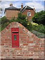
Postbox, Hawkes End
A George V postbox still in use.
Image: © Keith Williams
Taken: 23 Jun 2008
0.08 miles
9
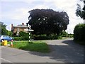
Bridle Brook Lane leaving Hawkes End
Image: © Keith Williams
Taken: 23 Jun 2008
0.08 miles
10
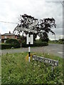
Direction Sign – Signpost on Washbrook Lane in Allesley
Located on a grass triangle in the centre of the junction of Washbrook Lane and Oak Lane in Allesley parish. 3 arms and annulus finial. See also https://www.geograph.org.uk/photo/6832482.
Milestone Society National ID: WA_SP2982A
Image: © Roadside Relics
Taken: 29 Jun 2023
0.08 miles