
IMAGES TAKEN NEAR TO
Grayswood Avenue, COVENTRY, CV5 8HL
Introduction
This page details the photographs taken nearby to Grayswood Avenue, CV5 8HL by members of the Geograph project.
The Geograph project started in 2005 with the aim of publishing, organising and preserving representative images for every square kilometre of Great Britain, Ireland and the Isle of Man.

There are currently over 7.5m images from over14,400 individuals and you can help contribute to the project by visiting https://www.geograph.org.uk
Image Map
Images are licensed for reuse under creativecommons.org/licenses/by-sa/2.0
Notes
- Clicking on the map will re-center to the selected point.
- The higher the marker number, the further away the image location is from the centre of the postcode.
Image Listing (43 Images Found)
Images are licensed for reuse under creativecommons.org/licenses/by-sa/2.0
Image
Details
Distance
2
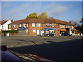
Corner shops
Built in the 1930's situated on the corner of Westbury Road and Grayswood Avenue. At one point had two grocers a wool shop,ladies hairdresser and a butcher.
Image: © Anthony Vosper
Taken: 28 Oct 2009
0.06 miles
3
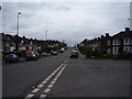
Grayswood Avenue
Looking up hill. In the 1960's both sides of the road were lined with Rowan trees now only a few remain.
Image: © Anthony Vosper
Taken: 28 Apr 2012
0.06 miles
4
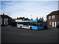
Bus at Grayswood Avenue bus terminus
A bus stands at the bus stop in the mouth of Westbury Road where it meets Grayswood Avenue. Apparently made huge to permit buses to turn around, this road junction ceased to be used by terminating buses when Coventry's bus network was recast in February 2012, only to regain that function less than four months later.
Image: © Richard Vince
Taken: 4 Oct 2011
0.06 miles
5
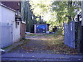
Vandalised Garages at the rear of the Holyhead Road shops
One time private lock-ups now derelict and covered with graffiti.
Image: © Anthony Vosper
Taken: 28 Oct 2009
0.06 miles
6
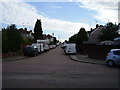
Cranford Road
Typical inter war years housing in Coventry.
Linking Westbury Road to Dulverton Avenue.
Image: © Anthony Vosper
Taken: 18 Aug 2012
0.08 miles
7
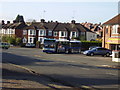
The Bus stops here
Westbury Road, the terminus of the local No1 bus service. Chapelfields to the City centre.
Image: © Anthony Vosper
Taken: 28 Oct 2009
0.08 miles
8
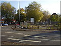
All that remains of the Toll Gate Garage
Built in the 1930's situated on the junction of Grayswood Avenue and the Holyhead Road. All that is left is a pile of rubble.
Image: © Anthony Vosper
Taken: 28 Oct 2009
0.09 miles
9
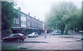
Holyhead Road shops
Looking from the end of the shops, by the entrance to Lake View Park, towards the junction with Grayswood Avenue at the other end of the row.
Image: © E Gammie
Taken: 27 May 2006
0.09 miles
10
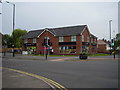
Holyhead Road, Tesco Express
Built on the site of Image on a busy urban crossroads.
Image: © Anthony Vosper
Taken: 7 Jun 2014
0.09 miles