
IMAGES TAKEN NEAR TO
Maudslay Road, COVENTRY, CV5 8EJ
Introduction
This page details the photographs taken nearby to Maudslay Road, CV5 8EJ by members of the Geograph project.
The Geograph project started in 2005 with the aim of publishing, organising and preserving representative images for every square kilometre of Great Britain, Ireland and the Isle of Man.

There are currently over 7.5m images from over14,400 individuals and you can help contribute to the project by visiting https://www.geograph.org.uk
Image Map
Images are licensed for reuse under creativecommons.org/licenses/by-sa/2.0
Notes
- Clicking on the map will re-center to the selected point.
- The higher the marker number, the further away the image location is from the centre of the postcode.
Image Listing (65 Images Found)
Images are licensed for reuse under creativecommons.org/licenses/by-sa/2.0
Image
Details
Distance
1
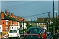
Maudslay Road
Looking down Maudslay Road with half of the Maudslay public house visible at the bottom. In the distance can be seen two local landmarks: the gasometer at Foleshill gasworks in SP3483 ( Image] ), demolished on 22nd September 2002 and the spire of St George's church on Barkers Butts Lane (SP3280 Image] ).
Image: © PGJ
Taken: Unknown
0.01 miles
2
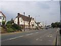
Chapel Fields, Coventry
Looking east along Allesley Old road with the local shops and The Maudslay on the left.
Image: © David Stowell
Taken: 23 Jul 2005
0.09 miles
3
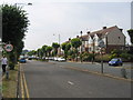
Allesley Old Road, Coventry
In Chapel Fields, looking west.
Image: © David Stowell
Taken: 23 Jul 2005
0.09 miles
4
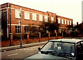
Former Massey Ferguson offices, Maudslay Road
Taken during demolition of the factory in 1985. Madeira Croft was later built on the site. A 2013 photo ( Image] ) shows the changes - the bus stop has been modernised but is in the same location.
See also: Image] and Image]
Image: © FEG
Taken: Unknown
0.09 miles
5
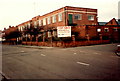
Engineering factory, Maudslay Road
The former offices of Massey Ferguson during demolition works in 1985. The sign advertised a sale by tender 12th October 1984 of 100,000 square feet with outline planning consent for residential development. Madeira Croft was later built on the site.
See also: Image] and Image]
In 2013: Image]
Image: © FEG
Taken: Unknown
0.09 miles
6
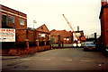
Factory demolition, Maudslay Road
Factory buildings at the rear of the former Massey Ferguson site being demolished in 1985. The sign advertised a sale by tender 12th October 1984 of 100,000 square feet with outline planning consent for residential development. Madeira Croft was later built on the site.
See also: Image] and Image]
Image: © FEG
Taken: Unknown
0.09 miles
7
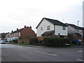
Maudslay Road and corner of Madeira Croft
The houses in Maudslay Road were constructed in the 1920s and those in Madeira Croft were built in the 1980s/90s on the site of the former Massey Ferguson offices and works.
The same location in 1985: Image]
Image: © E Gammie
Taken: 20 Dec 2013
0.09 miles
9
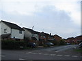
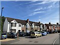
Madeira Croft off Maudslay Road
Madeira Croft stands on the former site of a Massey Ferguson engineering factory demolished in 1985 ( Image] ).
Image: © E Gammie
Taken: 20 Dec 2013
0.10 miles
10
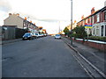
Maudslay Road
Mainly 1920s houses, typical of many built during the inter-war years when Coventry's population rapidly increased. There are some infills built in the last quarter of the 20th century on the site of a factory and Sutton's bakery. The upper half of the Maudslay pub (in SP3179) is just visible at the bottom of the road.
Maudslay Motor Co. was an early car manufacturing company founded in 1902.
Image: © E Gammie
Taken: 7 Nov 2010
0.10 miles