
IMAGES TAKEN NEAR TO
Allesley Old Road, COVENTRY, CV5 8DF
Introduction
This page details the photographs taken nearby to Allesley Old Road, CV5 8DF by members of the Geograph project.
The Geograph project started in 2005 with the aim of publishing, organising and preserving representative images for every square kilometre of Great Britain, Ireland and the Isle of Man.

There are currently over 7.5m images from over14,400 individuals and you can help contribute to the project by visiting https://www.geograph.org.uk
Image Map
Images are licensed for reuse under creativecommons.org/licenses/by-sa/2.0
Notes
- Clicking on the map will re-center to the selected point.
- The higher the marker number, the further away the image location is from the centre of the postcode.
Image Listing (174 Images Found)
Images are licensed for reuse under creativecommons.org/licenses/by-sa/2.0
Image
Details
Distance
1
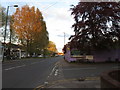
Along Allesley Old Road
This view along the road is looking towards Coventry.
Image: © Keith Williams
Taken: 30 Apr 2015
0.03 miles
2
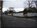
Derelict site, Mount Street
This site has been empty for a number of years and is in danger of becoming overgrown.
Image: © Anthony Vosper
Taken: 28 Apr 2012
0.03 miles
3
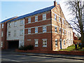
Coventry Watch Museum Project site of plaque on 51 Allesley Old Road
This modern block of apartments replaced the workshop of Frederick Trahern, manufacturer of fine gold watch cases. His business started in the late 19th Century and the family continued to manufacture cases here until the late 1960s.
The original plaque is missing but probably stated
Workshop of Frederick Trahern - Watch Case Maker - 1874 - 1970
Image: © 360Libre
Taken: 23 Feb 2018
0.03 miles
4
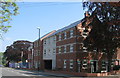
Mount Street to Lord Street, Allesley Old Road
This new block of apartments has been built on the site of the old Antelope Services, demolished about 2005. Before the construction of the service station in the 1970s, the near corner at Mount Street was occupied by no. 61 Allesley Old Road, a master watchmaker's house with workshop behind.
In 2012 : Image]
Image: © E Gammie
Taken: 12 May 2016
0.03 miles
5
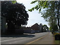
Antelope House, Allesley Old Road
New apartments have now been constructed on the site of the former Antelope Services which had been left undeveloped since its demolition around 2005. Before the construction of the service station in the 1970s the Allesley Old Road frontage between Lord Street and Mount street housed a short group of shops with accommodation above set back from the road, book-ended by two master watchmaker dwellings with workshops dating from the second half of the 19th century.
Image: © E Gammie
Taken: 12 May 2016
0.03 miles
6
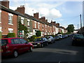
Coventry, Mount Street
Victorian redbrick terraces in Chapel Fields.
Image: © Mike Faherty
Taken: 3 Jul 2010
0.04 miles
7
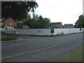
Coventry, development site
On Allesley Old Road, between Mount and Lord Streets.
Image: © Mike Faherty
Taken: 3 Jul 2010
0.05 miles
8
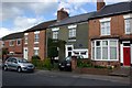
2 Mount Street
A former watch making premises, identified by the Coventry Watch Museum Project plaque, shown here Image
This is the 14th site on the Coventry Watchmakers' Heritage Trail.
The next site on the trail is Image
The prior site on the trail is Image
Image: © Keith Williams
Taken: 4 Apr 2009
0.06 miles
9
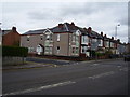
Dental practice, Sir Thomas White's Road
Catering for both NHS and Private patients.
Image: © Anthony Vosper
Taken: 28 Apr 2012
0.06 miles
10
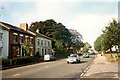
Allesley Old Road, 1981
Just visible beyond the two copper beeches on the left is a petrol station constructed in the 1970s on the site of former master watchmakers' houses. Since this photo was taken it has been demolished and the site remains undeveloped in 2013. One of the two beeches has been felled in the intervening years.
The buildings on the left are at the northern edge of the 19th century Chapelfields bounded by Craven Street, Mount Street and Allesley Old Road which housed watchmakers' premises. The current Chapelfields encompasses a larger area.
Allesley Old Road itself once formed part of an old coach road between London and Holyhead when it was the turnpike road to Birmingham, before being bypassed by the construction of Holyhead Road as part of Telford's 1830s improvements to the route.
In 2013: Image]
Image: © FCG
Taken: Unknown
0.06 miles