
IMAGES TAKEN NEAR TO
Shelfield Close, COVENTRY, CV5 7HR
Introduction
This page details the photographs taken nearby to Shelfield Close, CV5 7HR by members of the Geograph project.
The Geograph project started in 2005 with the aim of publishing, organising and preserving representative images for every square kilometre of Great Britain, Ireland and the Isle of Man.

There are currently over 7.5m images from over14,400 individuals and you can help contribute to the project by visiting https://www.geograph.org.uk
Image Map
Images are licensed for reuse under creativecommons.org/licenses/by-sa/2.0
Notes
- Clicking on the map will re-center to the selected point.
- The higher the marker number, the further away the image location is from the centre of the postcode.
Image Listing (137 Images Found)
Images are licensed for reuse under creativecommons.org/licenses/by-sa/2.0
Image
Details
Distance
1

Trees alongside the A45
An avenue of trees planted to screen the A45 from the houses alongside. The band of snow that caused disruption in parts of England and Wales didn't amount to much more than 4-5cm here and had little effect. Here the snow is falling steadily at 4:30pm.
Image: © E Gammie
Taken: 2 Feb 2009
0.05 miles
2

Trees alongside the A45
An avenue of trees screening the A45 (beyond the hedge on the left) from the houses in Mount Nod. The houses to the left, on the opposite side of the A45, were built closer to the road and only have the benefit of a hedge as a screen.
Image: © E Gammie
Taken: 16 Jan 2008
0.07 miles
3
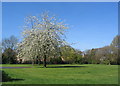
Blossom in the brookstray green
One of the greens alongside the brook running through Mod Nod estate. Flats on Nod Rise just visible behind the trees.
Image: © E Gammie
Taken: 15 Apr 2014
0.07 miles
4
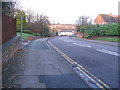
Nod Rise, Coventry
Nod Rise drops steeply down from Broad Lane to the brookstray.
Image: © E Gammie
Taken: 16 Nov 2008
0.07 miles
5
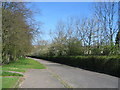
Road to nowhere
Not a country lane - the A45 Dunchurch Highway runs behind the hedge on the right and this road runs parallel to it for a short distance but stops before the green by the brook. It did not pre-date the 1930s construction of the highway and may have been designed as a service road but there is no turning point at the bottom.
Image: © E Gammie
Taken: 15 Apr 2014
0.07 miles
6
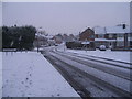
Snow on Nod Rise
Approximately 4.30pm and it's snowing steadily although no problem for traffic at present.
Image: © E Gammie
Taken: 2 Feb 2009
0.08 miles
7
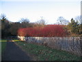
Shrubs screening the A45
These shrubs, which I think are Cornus alba 'Sibirica', screen the A45 Dunchurch Highway from the brookstray and provide a nice splash of colour in the winter.
Image: © E Gammie
Taken: 18 Jan 2009
0.08 miles
8
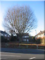
Beech tree, Nod Rise
A large beech forms the focal point for a group of houses off Nod Rise.
Image: © E Gammie
Taken: 29 Nov 2016
0.08 miles
9
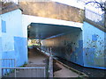
Subway under the A45
Enticing, isn't it? In its defence, you can see straight through to the other end, unlike other subways in Coventry.
Venture inside: http://www.geograph.org.uk/photo/365626
Image: © E Gammie
Taken: 29 Nov 2007
0.09 miles
10

A45 Dunchurch Highway
The Dunchurch Highway section of the A45 through Coventry's southern suburbs. On the left is the parapet of the bridge over a brook ( Image] ).
Image: © E Gammie
Taken: 26 Dec 2015
0.09 miles