IMAGES TAKEN NEAR TO
Upper Eastern Green Lane, COVENTRY, CV5 7DD
Introduction
This page details the photographs taken nearby to Upper Eastern Green Lane, CV5 7DD by members of the Geograph project.
The Geograph project started in 2005 with the aim of publishing, organising and preserving representative images for every square kilometre of Great Britain, Ireland and the Isle of Man.

There are currently over 7.5m images from over14,400 individuals and you can help contribute to the project by visiting https://www.geograph.org.uk
Image Map
Images are licensed for reuse under creativecommons.org/licenses/by-sa/2.0
Notes
- Clicking on the map will re-center to the selected point.
- The higher the marker number, the further away the image location is from the centre of the postcode.
Image Listing (20 Images Found)
Images are licensed for reuse under creativecommons.org/licenses/by-sa/2.0
Image
Details
Distance
1
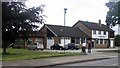
Eastern Green Village Hall
In the background is the Eastern Green Social Club.
Image: © Keith Williams
Taken: 19 Jun 2008
0.06 miles
2
Poachers Retreat Hockley Lane
This pub closed early in 2011 or late 2010. see Image
Image: © Nigel Mykura
Taken: 6 Mar 2011
0.06 miles
4
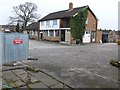
Poachers Retreat Hockley Lane
The pub has been closed and in January 2011 the council discussed an application from James O'Flanagan Ltd to build six houses on this site. They did not have any objection.
Image: © Nigel Mykura
Taken: 6 Mar 2011
0.07 miles
5
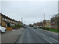
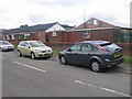
Upper Eastern Green Lane
Looking north west.
Image: © JThomas
Taken: 11 Mar 2017
0.09 miles
6
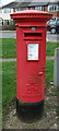
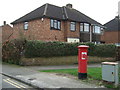
Elizabeth II postbox on Hockley Avenue, Upper Eastern Green
Postbox No. CV5 364.
See Image] for context.
Image: © JThomas
Taken: 11 Mar 2017
0.16 miles
8
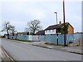
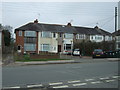
Houses on Hockley Avenue, Upper Eastern Green
Showing position of Postbox No. CV5 364.
See Image] for postbox.
Image: © JThomas
Taken: 11 Mar 2017
0.17 miles
9
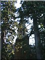
St Andrews church, Eastern Green
The spire of St Andrews, almost hidden behind two Scots pines.
Image: © E Gammie
Taken: 10 Oct 2010
0.18 miles
10
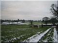
Farmland Near Upper Eastern Green
On the skyline (left) you can just see the Agco (ex Massey Ferguson) tower block. Further right on the skyline are three large conifers obscuring St. Andrew's Church, Eastern Green.
Image: © John Winterbottom
Taken: 28 Dec 2005
0.18 miles