
IMAGES TAKEN NEAR TO
Broad Lane, COVENTRY, CV5 7AU
Introduction
This page details the photographs taken nearby to Broad Lane, CV5 7AU by members of the Geograph project.
The Geograph project started in 2005 with the aim of publishing, organising and preserving representative images for every square kilometre of Great Britain, Ireland and the Isle of Man.

There are currently over 7.5m images from over14,400 individuals and you can help contribute to the project by visiting https://www.geograph.org.uk
Image Map
Images are licensed for reuse under creativecommons.org/licenses/by-sa/2.0
Notes
- Clicking on the map will re-center to the selected point.
- The higher the marker number, the further away the image location is from the centre of the postcode.
Image Listing (69 Images Found)
Images are licensed for reuse under creativecommons.org/licenses/by-sa/2.0
Image
Details
Distance
1
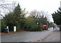
Broad Lane, Coventry
A little before 9am on a Wednesday morning and the normally busy Broad Lane has been closed between Fletchamstead Highway and Nod Rise whilst two workmen clear a fallen tree by the bus stop. Twenty minutes later, there were only twigs left to sweep up.
Image: © E Gammie
Taken: 18 Nov 2009
0.02 miles
3
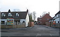
New build, Broad Lane
A group of seven 4-5 bedroom new houses have been built behind existing early 20th century houses on Broad Lane, presumably in what were formerly large rear gardens.
Image: © E Gammie
Taken: 17 Mar 2013
0.05 miles
4
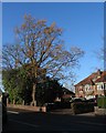
Oak, Broad Lane
In the front garden of a c. 1930s semi-detached house on the north side of Broad Lane.
Image: © E Gammie
Taken: 12 Dec 2011
0.05 miles
5
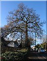
Oak, Broad Lane
On the south side of Broad Lane near the junction with Fletchamstead Highway (A45).
Image: © E Gammie
Taken: 13 Dec 2011
0.07 miles
6
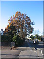
Oak, Broad Lane
On the south side of Broad Lane near the junction with the A45.
Image: © E Gammie
Taken: 29 Nov 2016
0.07 miles
7
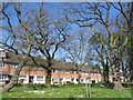
By Dunchurch Highway
1960s houses facing Dunchurch Highway (A45) stand behind mature trees.
Image: © E Gammie
Taken: 15 Apr 2014
0.09 miles
8
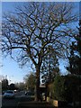
Oak, Broad Lane
On the north side of Broad Lane by the junction with Nod Rise.
Image: © E Gammie
Taken: 12 Dec 2011
0.10 miles
9

Trees alongside the A45
An avenue of trees planted to screen the A45 from the houses alongside. The band of snow that caused disruption in parts of England and Wales didn't amount to much more than 4-5cm here and had little effect. Here the snow is falling steadily at 4:30pm.
Image: © E Gammie
Taken: 2 Feb 2009
0.10 miles
10
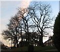
Trees by Dunchurch Highway
Houses facing the A45, dating from the 1960s, are set behind mature trees. The road on the left is a service road.
Image: © E Gammie
Taken: 21 Nov 2012
0.10 miles