IMAGES TAKEN NEAR TO
Broad Lane, COVENTRY, CV5 7AN

Introduction

This page details the photographs taken nearby to Broad Lane, CV5 7AN by members of the Geograph project.

The Geograph project started in 2005 with the aim of publishing, organising and preserving representative images for every square kilometre of Great Britain, Ireland and the Isle of Man.

There are currently over 7.5m images from over14,400 individuals and you can help contribute to the project by visiting https://www.geograph.org.uk

Image Map


Images are licensed for reuse under creativecommons.org/licenses/by-sa/2.0
Notes
  • Clicking on the map will re-center to the selected point.
  • The higher the marker number, the further away the image location is from the centre of the postcode.

Image Listing (64 Images Found)

Images are licensed for reuse under creativecommons.org/licenses/by-sa/2.0
  • ...
Image
Details
Distance
1
DIY store
Sheppards now occupy the whole of the building at the corner of Wildcroft Road and Broad Lane. In the past the units to the left were occupied by a hairdresser, florist and butcher's shop.
Image: © E Gammie Taken: 26 Sep 2015
0.05 miles
2
Sheppard?s DIY
Image: © Alan Hughes Taken: 23 Sep 2021
0.05 miles
3
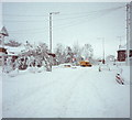
Wildcroft Road in snow,1990
On the morning of Saturday 8th December 1990, a heavy localised snowfall accompanied by strong winds caused chaos on the roads in the area. This photograph was taken as the snowfall ceased. The yellow van (possibly telephone maintenance) is trying to negotiate the junction from Broad Lane into Wildcroft Road. The snow is piled to the tops of the garden walls approximately 80cm high and is weighing down tree branches and telephone wires.
Image: © E Gammie Taken: 8 Dec 1990
0.06 miles
4
Brethren's Meeting Room, Wildcroft Road
Image: © Keith Williams Taken: 23 Jun 2008
0.06 miles
5
Broad Lane
The box junction at Wildcroft Road, on a frosty day. The bus shelter on the left is redundant as buses ceased running down this section of Broad Lane to the common in February 2012.
Image: © E Gammie Taken: 13 Dec 2012
0.06 miles
6
Broad Lane and A45 crossroads
The new traffic island with traffic lights layout at the Broad Lane crossing of the A45 requires a gentle reminder to 'give way to traffic from right' from the light array in the foreground.
Image: © E Gammie Taken: 25 Dec 2015
0.08 miles
7
Houses on Wildcroft Rd
These substantial red brick semi detached houses probably dating from the 20's or 30's are on the east side of the road between the junctions with Gorseway and Heathfield Rd
Image: © Nigel Mykura Taken: 11 Feb 2012
0.08 miles
8
Roadworks, A45 and Broad Lane
Roadworks under way to alter the traffic-light controlled crossroads of Broad Lane and the A45 to a roundabout with traffic lights. The junction was regarded as a 'pinch-point'. On the far side the Wing Wah restaurant displays a desperate but not visible 'open as usual' sign. At the time of this photo the traffic is travelling round a partially built roundabout but still subject to the traffic light sequence. A 2012 view: Image
Image: © E Gammie Taken: 16 Oct 2015
0.09 miles
9
A45 at Wing Wah Restaurant
Image: © Colin Pyle Taken: 27 Feb 2012
0.10 miles
10
Stationary traffic, Dunchurch Highway
Sunday 9th December 1990, the morning after a major snowfall paralysed the roads in the area. The Dunchurch Highway (A45) between Broad Lane and Pickford Way was closed overnight, the undulating profile having caused the undoing of several vehicles. The snow is starting to thaw in the sunshine and people are returning to vehicles that have been stranded overnight. Snow covered roofs of Allesley Park in the distance.
Image: © E Gammie Taken: 9 Dec 1990
0.11 miles
  • ...