
IMAGES TAKEN NEAR TO
Toledo Close, Coventry Business Park, COVENTRY, CV5 6UN
Introduction
This page details the photographs taken nearby to Toledo Close, Coventry Business Park, CV5 6UN by members of the Geograph project.
The Geograph project started in 2005 with the aim of publishing, organising and preserving representative images for every square kilometre of Great Britain, Ireland and the Isle of Man.

There are currently over 7.5m images from over14,400 individuals and you can help contribute to the project by visiting https://www.geograph.org.uk
Image Map
Images are licensed for reuse under creativecommons.org/licenses/by-sa/2.0
Notes
- Clicking on the map will re-center to the selected point.
- The higher the marker number, the further away the image location is from the centre of the postcode.
Image Listing (51 Images Found)
Images are licensed for reuse under creativecommons.org/licenses/by-sa/2.0
Image
Details
Distance
1
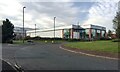
Astleys, Renown Avenue, Coventry Business Park
Claimed to be Coventry's oldest business, known particularly for workwear and equipment, supplied direct and online: "If you can't eat it, Astleys probably sell it". https://www.astleys.co.uk
Image: © Robin Stott
Taken: 6 Nov 2020
0.08 miles
2
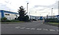
Spitfire Close, Coventry Business Park, Canley
Spitfire Close is a gated area for a number of businesses, small and medium-sized compared to the big beasts on most of the park Image
Image: © Robin Stott
Taken: 6 Nov 2020
0.08 miles
3

Mission Foods, Coventry Business Park
"Europe's leading flat bread company" http://www.missionfoods.eu/consumer.html
Image: © Robin Stott
Taken: 6 Nov 2020
0.10 miles
4
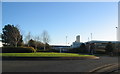
Coventry Business Park
Industrial unit and traffic island off Renown Avenue.
Image: © E Gammie
Taken: 25 Nov 2016
0.10 miles
5
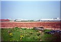
Site of Standard-Triumph factory
The Standard-Triumph factory occupied the southern half of SP3078 during much of the 20th century. This photo was taken shortly after the last remaining shadow factory building, dating from the 1930s, had been demolished and cleared. The rest of the site had been cleared in preceding years and industrial/business units had been constructed, some of which can be seen, including the side wall of a large supermarket, on the left. A last, lingering link is the Unipart name on the two white warehouses. Small to medium-sized business units now occupy the foreground area.
Image: © E Gammie
Taken: Unknown
0.10 miles
6
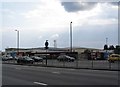
The former Fletch, Fletchamstead Highway
The building which housed the Fletch public house and latterly a car dealership was demolished in March 2019 and the site is due to become student accommodation by September 2020 according to the hoardings surrounding it.
In 2008 : Image]
Image: © E Gammie
Taken: 16 Jul 2019
0.11 miles
7
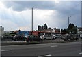
The former Fletch, Fletchamstead Highway
The building, at the corner of Fletchamstead Highway and Standard Avenue, which housed the Fletch public house and latterly a car dealership was demolished in March 2019 and the site is due to become student accommodation by September 2020 according to the hoardings surrounding it.
In 2009: Image]
Image: © E Gammie
Taken: 16 Jul 2019
0.11 miles
8
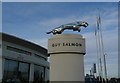
Big cat, Fletchamstead Highway
The beautifully styled leaping cat mascot of Jaguar cars, displayed outside the dealership on the A45. The mascot is based on a 1937 design by F Gordon Crosby and has been associated with Jaguar since that time.
Image: © E Gammie
Taken: 23 Dec 2009
0.12 miles
9
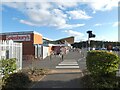
Fletchampstead Highway Sainsbury's
From the bus stop on Herald Avenue.
Image: © Gerald England
Taken: 24 Sep 2021
0.12 miles
10
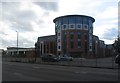
Red Queen, Fletchamstead Highway
Purpose-built student accommodation, aimed at Warwick University students, completed in 2020. The building stands at the corner of Standard Avenue and Fletchamstead Highway on the site of the former Fletch public house whose art deco style rotunda it echoes but at a much larger scale - its six storeys towering above the neighbouring two-storey houses and Jaguar dealership.
The Fletch in 2008: Image]
Image: © E Gammie
Taken: 8 Sep 2020
0.12 miles