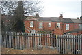
IMAGES TAKEN NEAR TO
Kensington Road, COVENTRY, CV5 6GG
Introduction
This page details the photographs taken nearby to Kensington Road, CV5 6GG by members of the Geograph project.
The Geograph project started in 2005 with the aim of publishing, organising and preserving representative images for every square kilometre of Great Britain, Ireland and the Isle of Man.

There are currently over 7.5m images from over14,400 individuals and you can help contribute to the project by visiting https://www.geograph.org.uk
Image Map
Images are licensed for reuse under creativecommons.org/licenses/by-sa/2.0
Notes
- Clicking on the map will re-center to the selected point.
- The higher the marker number, the further away the image location is from the centre of the postcode.
Image Listing (134 Images Found)
Images are licensed for reuse under creativecommons.org/licenses/by-sa/2.0
Image
Details
Distance
1

Kensington Road
Early 20th Centuries housing, first shown on the 1914 25 inch map.
Image: © Ian Capper
Taken: 25 Sep 2021
0.04 miles
2
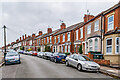
Kensington Road
Early 20th Centuries housing, first shown on the 1914 25 inch map.
Image: © Ian Capper
Taken: 25 Sep 2021
0.05 miles
3
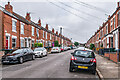
Westwood Road
Early 20th Century housing, first shown on the 1914 25 inch map.
Image: © Ian Capper
Taken: 25 Sep 2021
0.05 miles
4
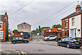
Industrial estate, Westwood Road
Small industrial estate housing a printing business, sited on a bend in Westwood Road, a road first shown on the 1914 25 inch map.
Image: © Ian Capper
Taken: 25 Sep 2021
0.06 miles
5

Kensington Court
Small industrial estate off Kensington Road, marked on the 1939 25 inch map as a laundry, a function now commemorated in one of the units, The Old Laundry Studio, occupied by a bespoke furniture maker.
Image: © Ian Capper
Taken: 25 Sep 2021
0.07 miles
6
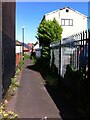
Footpath from Westwood Road to Albany Road, Coventry
One of the many footpaths connecting streets in the Earlsdon district of Coventry.
Image: © A J Paxton
Taken: 12 Jun 2021
0.07 miles
7
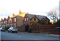
Melbourne Road
A detached house at the end of the terraced Melbourne Road. The lack of chimneys suggest it was built in the latter part of the 20th century in contrast to the other houses dating from c. 1906.
Image: © E Gammie
Taken: 23 Jan 2012
0.07 miles
8
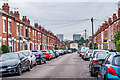
Westwood Road
Early 20th Century housing, first shown on the 1914 25 inch map.
Image: © Ian Capper
Taken: 25 Sep 2021
0.08 miles
9

Broomfield Road
c.turn of the 19th/20th Centuries housing, first shown on the 1906 25 inch map.
Image: © Ian Capper
Taken: 25 Sep 2021
0.08 miles