
IMAGES TAKEN NEAR TO
Warwick Avenue, COVENTRY, CV5 6DJ
Introduction
This page details the photographs taken nearby to Warwick Avenue, CV5 6DJ by members of the Geograph project.
The Geograph project started in 2005 with the aim of publishing, organising and preserving representative images for every square kilometre of Great Britain, Ireland and the Isle of Man.

There are currently over 7.5m images from over14,400 individuals and you can help contribute to the project by visiting https://www.geograph.org.uk
Image Map
Images are licensed for reuse under creativecommons.org/licenses/by-sa/2.0
Notes
- Clicking on the map will re-center to the selected point.
- The higher the marker number, the further away the image location is from the centre of the postcode.
Image Listing (127 Images Found)
Images are licensed for reuse under creativecommons.org/licenses/by-sa/2.0
Image
Details
Distance
1
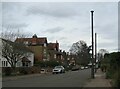
Warwick Avenue, Earlsdon
The most likely purpose I can suggest for the pole in the foreground was as a sewer vent pipe. These were installed in Victorian times to vent gases that might build up in the sewers below. The large semi-detached and detached houses lining this road were constructed in the early 1900s and the 1920s with a few later 20th century additions. The pole is unlikely to be a lamp standard being of a much larger size than the short lantern-topped poles seen in old photographs of Earlsdon, nor is it anything to do with tram-line infrastructure as no tram routes ran along this road.
Detail of the base of the pipe: Image]
Image: © E Gammie
Taken: 24 Feb 2021
0.02 miles
2
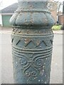
Decorated iron pipe, Warwick Avenue
The base of what I think is a sewer vent pipe.
Context: Image]
Image: © E Gammie
Taken: 24 Feb 2021
0.02 miles
3
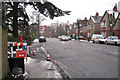
Earlsdon Avenue South
From the corner of Warwick Avenue. Postbox ID: CV5 151.
Image: © Robin Stott
Taken: 14 Jan 2010
0.06 miles
4
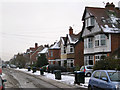
Styvechale Avenue
Pronounced sty-chl. Generally spelt Stivichall. It was one of six parishes absorbed by the City of Coventry in 1932. The Boundary Extension Act of 1931 paved the way for the city's expansion.
Image: © Robin Stott
Taken: 14 Jan 2010
0.06 miles
7
Warwick Avenue, Earlsdon
A quiet road, part of the cycle route from the city centre to Warwick university, marked as National Route 52 on the map.
Image: © E Gammie
Taken: 5 May 2010
0.09 miles
8

Snow on branch with bracket fungus, Stivichall Common
Image: © A J Paxton
Taken: 3 Mar 2018
0.09 miles
9
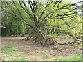
Edge of Stivichall Common
There are several of these "Eeyore's house" constructions scattered around the woodland.
Image: © E Gammie
Taken: 1 May 2021
0.10 miles
10
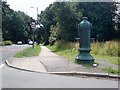
Drinking fountain on Earlsden Avenue South
There is currently a fund raising effort in progress to get this drinking fountain restored.
Image: © Keith Williams
Taken: 1 Jul 2008
0.10 miles