
IMAGES TAKEN NEAR TO
Stoneleigh Avenue, COVENTRY, CV5 6BZ
Introduction
This page details the photographs taken nearby to Stoneleigh Avenue, CV5 6BZ by members of the Geograph project.
The Geograph project started in 2005 with the aim of publishing, organising and preserving representative images for every square kilometre of Great Britain, Ireland and the Isle of Man.

There are currently over 7.5m images from over14,400 individuals and you can help contribute to the project by visiting https://www.geograph.org.uk
Image Map
Images are licensed for reuse under creativecommons.org/licenses/by-sa/2.0
Notes
- Clicking on the map will re-center to the selected point.
- The higher the marker number, the further away the image location is from the centre of the postcode.
Image Listing (97 Images Found)
Images are licensed for reuse under creativecommons.org/licenses/by-sa/2.0
Image
Details
Distance
1

Stoneleigh Avenue , Coventry
A long residential street of medium sized early 20thC semi-detached houses in the south east corner of the square just to the west of Stivichall Common.
Image: © Nigel Mykura
Taken: 13 Aug 2010
0.04 miles
2
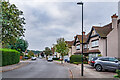
Stoneleigh Avenue
c.1920s/30s housing, with the road first shown in outline on the 1926 6 inch map without any buildings other than one semi-detached pair at the north end (see Image) and then complete with housing on the 1940 25 inch map.
Image: © Ian Capper
Taken: 25 Sep 2021
0.05 miles
3
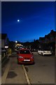
Woodland Avenue
Looking along Woodland Avenue at dusk with the moon standing overhead.
Image: © DS Pugh
Taken: 13 Dec 2018
0.06 miles
4
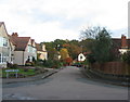
Eastleigh Avenue
A short road joining Stoneleigh Avenue, in the foreground, and Woodland Avenue. The trees behind the houses on Woodland Avenue are part of Stivichall Common, flanking Kenilworth Road.
Plans for the houses in this area, described as Styvechale Garden Village, were put forward shortly before WW1 and consisted mainly of substantial semi-detached dwellings. The war delayed building progress and they were completed in the 1920s.
Image: © E Gammie
Taken: 10 Nov 2012
0.06 miles
5

Woodland Avenue
c.1920s/30s housing, with the road first shown in outline on the 1926 6 inch map without only a few buildings and then complete with housing on the 1940 25 inch map.
Image: © Ian Capper
Taken: 25 Sep 2021
0.11 miles
6
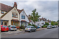
Stoneleigh Avenue
c.1920s/30s housing, with the road first shown in outline on the 1926 6 inch map without any buildings other than the semi-detached pair on the left of this photo (nos 3 & 5), and then complete with housing on the 1940 25 inch map.
Image: © Ian Capper
Taken: 25 Sep 2021
0.11 miles
7
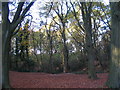
Devil's Dungeon
This area, within the woodland on Stivichall Common, was formerly quarried locally for building stone. Now its undulations and obstacles are a natural playground for kids on bikes.
Image: © E Gammie
Taken: 17 Nov 2011
0.12 miles
8
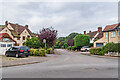
Southleigh Avenue
c.1920s/30s housing in a cul-de-sac off Stoneleigh Avenue, with both roads first shown in outline on the 1926 6 inch map without any buildings (bar one semi-detached pair at the north end of Stoneleigh Avenue - see Image) and then complete with housing on the 1940 25 inch map.
Image: © Ian Capper
Taken: 25 Sep 2021
0.12 miles
9
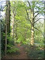
Stivichall Common, Kenilworth Road
An avenue of beeches, parallel to Kenilworth Road, coming into leaf.
Image: © E Gammie
Taken: 1 May 2021
0.12 miles
10
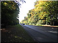
A429 Kenilworth Road
The road passes the trees of Styvechale Common by the Memorial Park.
Image: © E Gammie
Taken: 29 Oct 2007
0.12 miles