
IMAGES TAKEN NEAR TO
Southleigh Avenue, COVENTRY, CV5 6BY
Introduction
This page details the photographs taken nearby to Southleigh Avenue, CV5 6BY by members of the Geograph project.
The Geograph project started in 2005 with the aim of publishing, organising and preserving representative images for every square kilometre of Great Britain, Ireland and the Isle of Man.

There are currently over 7.5m images from over14,400 individuals and you can help contribute to the project by visiting https://www.geograph.org.uk
Image Map
Images are licensed for reuse under creativecommons.org/licenses/by-sa/2.0
Notes
- Clicking on the map will re-center to the selected point.
- The higher the marker number, the further away the image location is from the centre of the postcode.
Image Listing (88 Images Found)
Images are licensed for reuse under creativecommons.org/licenses/by-sa/2.0
Image
Details
Distance
1
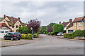
Southleigh Avenue
c.1920s/30s housing in a cul-de-sac off Stoneleigh Avenue, with both roads first shown in outline on the 1926 6 inch map without any buildings (bar one semi-detached pair at the north end of Stoneleigh Avenue - see Image) and then complete with housing on the 1940 25 inch map.
Image: © Ian Capper
Taken: 25 Sep 2021
0.03 miles
2
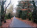
Canley Ford
The lane leading to Canley Ford, newly resurfaced. This part is an access route but does not run through the ford which is not open to motorised vehicles. The surrounding woodland has conservation area status.
Image: © E Gammie
Taken: 11 Dec 2016
0.05 miles
3
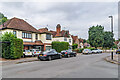
Stoneleigh Avenue
c.1920s/30s housing, with the road first shown in outline on the 1926 6 inch map without any buildings other than one semi-detached pair at the north end (see Image) and then complete with housing on the 1940 25 inch map.
Image: © Ian Capper
Taken: 25 Sep 2021
0.06 miles
4
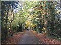
The lane to Canley Ford, Stivichall Common
Mixed deciduous woodland with holly and ivy, at its best in spring or autumn.
Image: © E Gammie
Taken: 11 Nov 2018
0.06 miles
5

Truncated tree
This stump, at the corner of the golf course boundary, was formerly an ivy-bound forked tree (seen in 2007: Image] ). The left bough had recently fallen, as evidenced by the bent metal fence to the left, and the rest of the tree has been cut away.
Image: © E Gammie
Taken: 9 Sep 2018
0.06 miles
6

Tree in a bind
Ivy has been winding its way round this tree for several years, by the looks of it.
Image: © E Gammie
Taken: 22 Jan 2007
0.06 miles
7
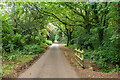
Canley Ford
Track passing through woodland on Stivichall Common.
Image: © Ian Capper
Taken: 25 Sep 2021
0.06 miles
8
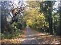
The lane from Canley Ford, Stivichall Common
Mixed deciduous woodland with holly and ivy, at its best in spring or autumn.
Image: © E Gammie
Taken: 11 Nov 2018
0.07 miles
9
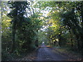
Canley Ford
The lane leading to Canley Ford, now a no-through-road.
Image: © E Gammie
Taken: 5 Nov 2012
0.07 miles
10
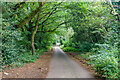
Canley Ford
Track passing through woodland on Stivichall Common.
Image: © Ian Capper
Taken: 25 Sep 2021
0.07 miles