
IMAGES TAKEN NEAR TO
Burnsall Road, COVENTRY, CV5 6BT
Introduction
This page details the photographs taken nearby to Burnsall Road, CV5 6BT by members of the Geograph project.
The Geograph project started in 2005 with the aim of publishing, organising and preserving representative images for every square kilometre of Great Britain, Ireland and the Isle of Man.

There are currently over 7.5m images from over14,400 individuals and you can help contribute to the project by visiting https://www.geograph.org.uk
Image Map
Images are licensed for reuse under creativecommons.org/licenses/by-sa/2.0
Notes
- Clicking on the map will re-center to the selected point.
- The higher the marker number, the further away the image location is from the centre of the postcode.
Image Listing (46 Images Found)
Images are licensed for reuse under creativecommons.org/licenses/by-sa/2.0
Image
Details
Distance
1
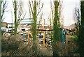
Fire damaged Whitefurze factory, 2002
The Whitefurze factory after a serious blaze destroyed the buildings on the site adjacent to Fletchamstead Highway. Scanned from a photo dated March 2002 - the fire occurred in January 2002. The factory was later rebuilt and can be seen in this photo :Image]
Image: © E Gammie
Taken: Unknown
0.01 miles
2
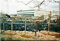
Fire damaged Whitefurze factory, 2002
The Whitefurze factory after a serious blaze destroyed the buildings on the site adjacent to Fletchamstead Highway. Scanned from a photo dated March 2002 - the fire occurred in January 2002. The factory was later rebuilt and can be seen in this photo :Image]
Image: © E Gammie
Taken: Unknown
0.01 miles
3
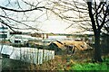
Fire damaged Whitefurze factory, 2002
The Whitefurze factory after a serious blaze destroyed the buildings on the site adjacent to Fletchamstead Highway. Scanned from a photo dated March 2002 - the fire occurred in January 2002. The factory was later rebuilt and can be seen in this photo :Image]
Image: © E Gammie
Taken: Unknown
0.02 miles
4
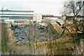
Fire damaged Whitefurze factory, 2002
The Whitefurze factory after a serious blaze destroyed the buildings on the site adjacent to Fletchamstead Highway. Scanned from a photo dated March 2002 - the fire occurred in January 2002. The factory was later rebuilt and can be seen in this photo :Image]
Image: © E Gammie
Taken: Unknown
0.03 miles
5
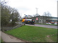
A45 Fletchamstead Highway
The entrance to the subway under the A45 to Burnsall Road from Prior Deram Walk. The Whitefurze factory building on the far side of the dual carriageway.
The A45 is embanked at this point to give it the elevation to cross the Coventry-Birmingham railway line.
Image: © E Gammie
Taken: 20 Mar 2014
0.06 miles
6
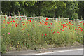
Poppies in the central reservation
The A45 has a wonderful, but temporary, display of poppies in the grassy central reservation
Image: © Malcolm Neal
Taken: 28 May 2017
0.08 miles
7
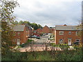
Apple Way
Part of the small estate built on the site of the former Sir Henry Parkes primary school between 2014-16.
Image: © E Gammie
Taken: 14 Oct 2017
0.09 miles
8
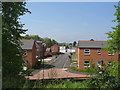
Apple Way
Part of the small estate built 2014-16 on the site of the former Sir Henry Parkes primary school. The builders equipment containers can still be seen at the end of the road
Image: © E Gammie
Taken: 12 May 2016
0.09 miles
9
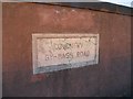
Fletchamstead Bridge parapet stone (E)
The stone incorporated into the eastern parapet of the bridge carrying the A45 Fltechmastead Highway over the Coventry-Birmingham railway line (Image]) bears the inscription 'Coventry by-pass road'. The opposite parapet: Image]
Image: © E Gammie
Taken: 22 Oct 2008
0.10 miles
10
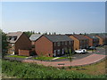
White Willow Park
New housing in Canley on the site of the former Sir Henry Parkes primary school.
Image: © E Gammie
Taken: 12 May 2016
0.11 miles